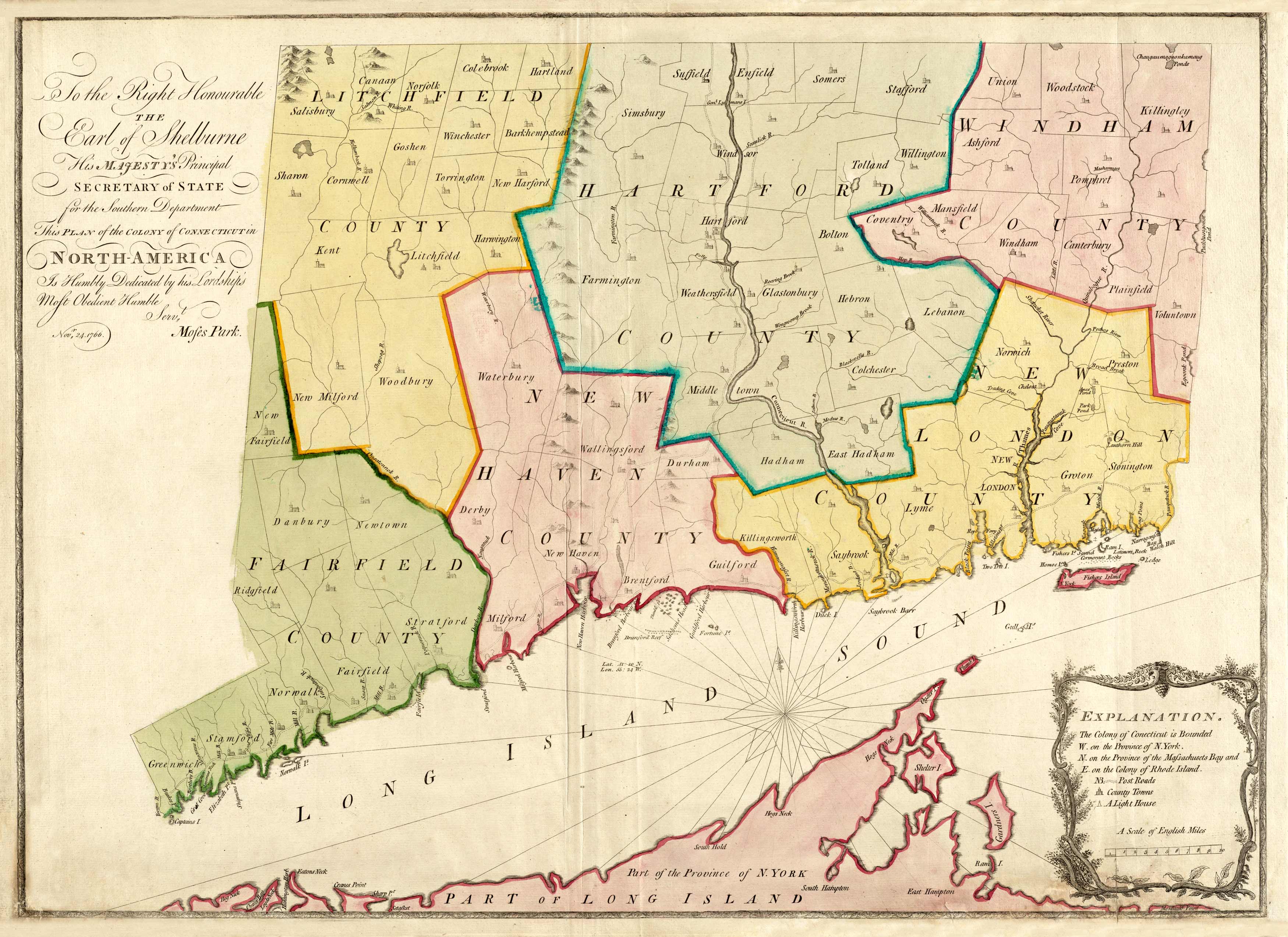
This 1766 map by Moses Park shows a plan of the colony of Connecticut.It shows Fairfield, Litchfield, New Haven, New London, and Hartford counties along with part of Long Island, New York. The map shows numerous islands, ponds, coves, and harbors along the coast. Rivers are identified; some minor topographic detail also depicted. Various towns and roads also shown.
Additional information
| Weight | 0.25 lbs |
|---|---|
| Dimensions | 22 × 31 × 0.002 in |
Map Maker: Park, Moses
Original Production Year: 1766
Original Production Year: 1766


