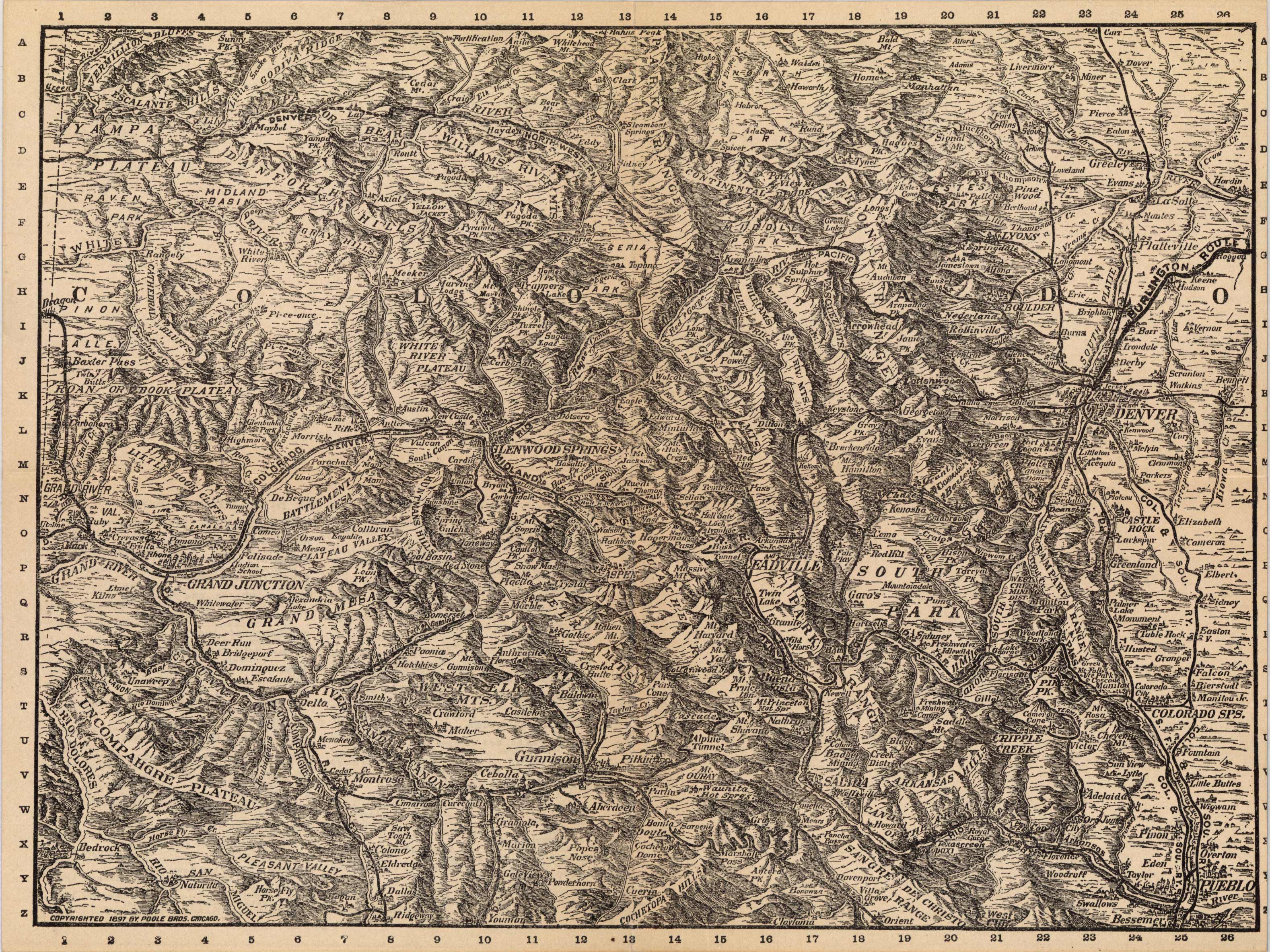
This detailed 1897 map of the Midland Route shows the expanse of the Rocky Mountains in Colorado with extensive identification of lakes, plateaus, cliffs, valleys, rivers, ridges, bluffs, passes, railways, and more. It labels everything as far south as Pueblo and goes slightly past Fort Collins. It stretches west to the Grand River and as far east as Bennett.
Additional information
| Weight | 0.25 lbs |
|---|---|
| Dimensions | 7.5 × 10 × 0.002 in |
Town Name: COLORADO
Map Maker: Poole Brothers
Original Production Year: 1897
Year: 1897
Map Maker: Poole Brothers
Original Production Year: 1897
Year: 1897


