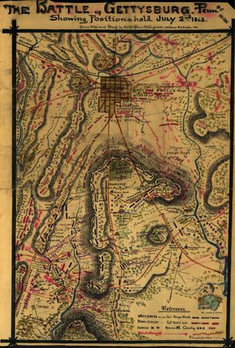
A neat hand-drawn scrapbook map of the Battle of Gettysburg from Robert Knox Sneden. Gives locations of specific units with some attempt to indicate movement (i.e. direction of charges and assaults) during the course of the day. Also indicates the usual landmarks (Culp’s Hill, Cemetery Ridge, Round Top, etc.) plus the locations of hospitals and headquarters. Color coding indicates the location of Union and Confederate forces.””
Additional information
| Weight | 0.25 lbs |
|---|---|
| Dimensions | 53 × 35.87 × 0.002 in |
Map Maker: Robert Knox Sneden
Original Production Year: 1865
Original Production Year: 1865


