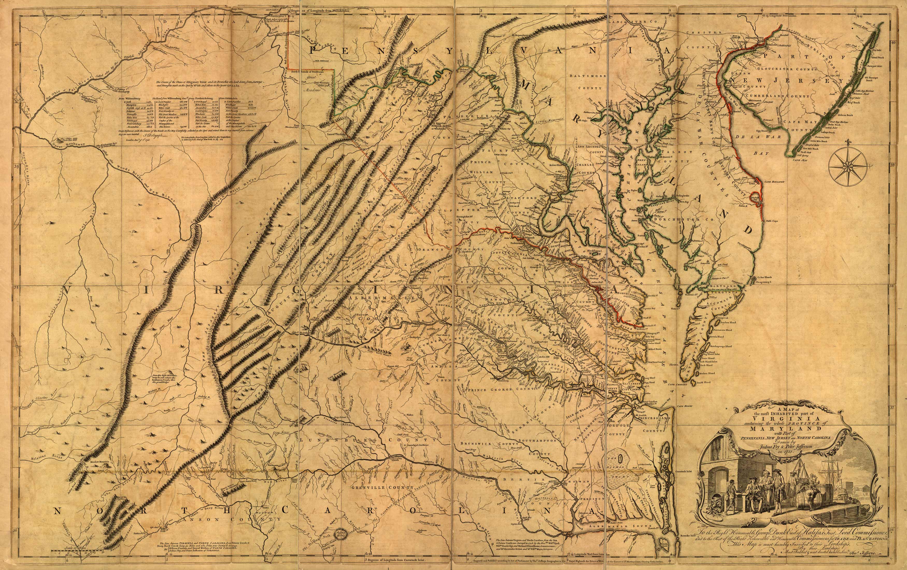
The Fry-Jefferson map, first published in 1751, was the definitive map of Virginia in the eighteenth century. Created by two of the colony’s most accomplished surveyors, Joshua Fry and Peter Jefferson, it included their completed border survey for the western bounds of the Northern Neck and a portion of the Virginia�North Carolina dividing line. For the first time the entire Virginia river system was properly delineated, and the northeast-southwest orientation of the Appalachian Mountains were fully displayed. Published in eight known editions, or states, the map was widely copied, and served as an important resource for future mapmakers. What made this project extraordinary was that Fry and Jefferson based the map on actual measurements and surveys of the land. The Fry-Jefferson map was renowned for its accuracy. It was heavily consulted by British generals during the Seven Years War, and also by Thomas Jefferson in writing Notes on the State of Virginia.
Additional information
| Weight | 0.25 lbs |
|---|---|
| Dimensions | 21.5 × 34 × 0.002 in |
Map Maker: Joshua Fry and Peter Jefferson
Original Production Year: 1751
Original Production Year: 1751


