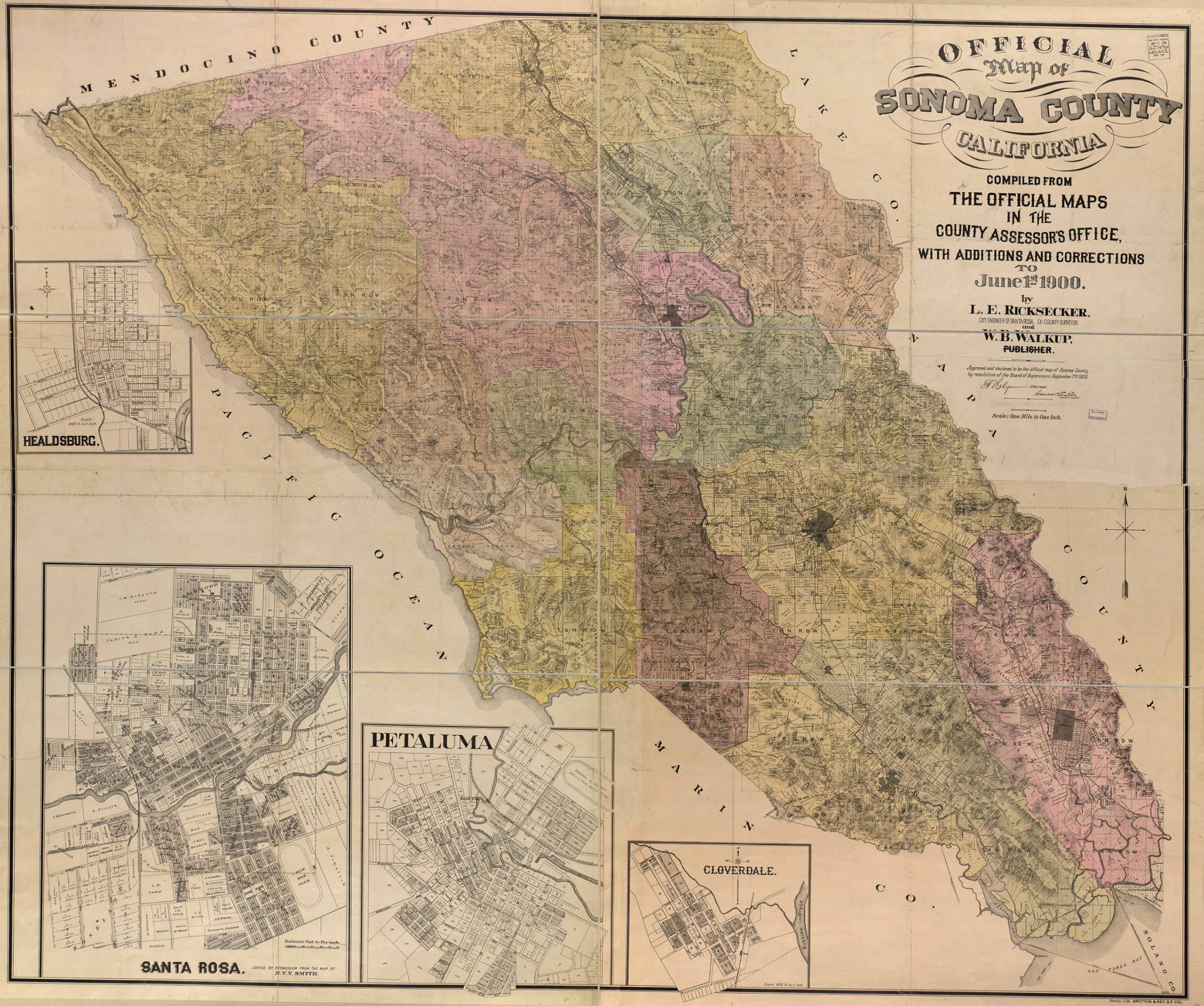
The Official Map of Sonoma County, California; Compiled from the official maps in the County Assessor’s office, with additions and corrections to June 1st, 1900. By L.E. Ricksecker the city engineer of Santa Rosa, ex county surveyor, and W.B. Walkup, publisher. Approved and declared to be the official map of Sonoma County by resolution by the board of supervision, September 7th, 1900. This map is scaled at one mile to one inch and features four insets including: Petaluma, Cloverdale, Santa Rosa and Healdsburg. Also featured is the Pacific Ocean, Marin County, Napa County, Mendocino County, and Lake County.
Additional information
| Weight | 0.25 lbs |
|---|---|
| Dimensions | 11 × 13 × 0.002 in |
Town Name: SONOMA
Map Maker: Ricksecker, L. E. (Lucius Edgar), W.B. Walkup & Co., Britton & Rey.
Original Production Year: 1900
Year: 1900
Map Maker: Ricksecker, L. E. (Lucius Edgar), W.B. Walkup & Co., Britton & Rey.
Original Production Year: 1900
Year: 1900


