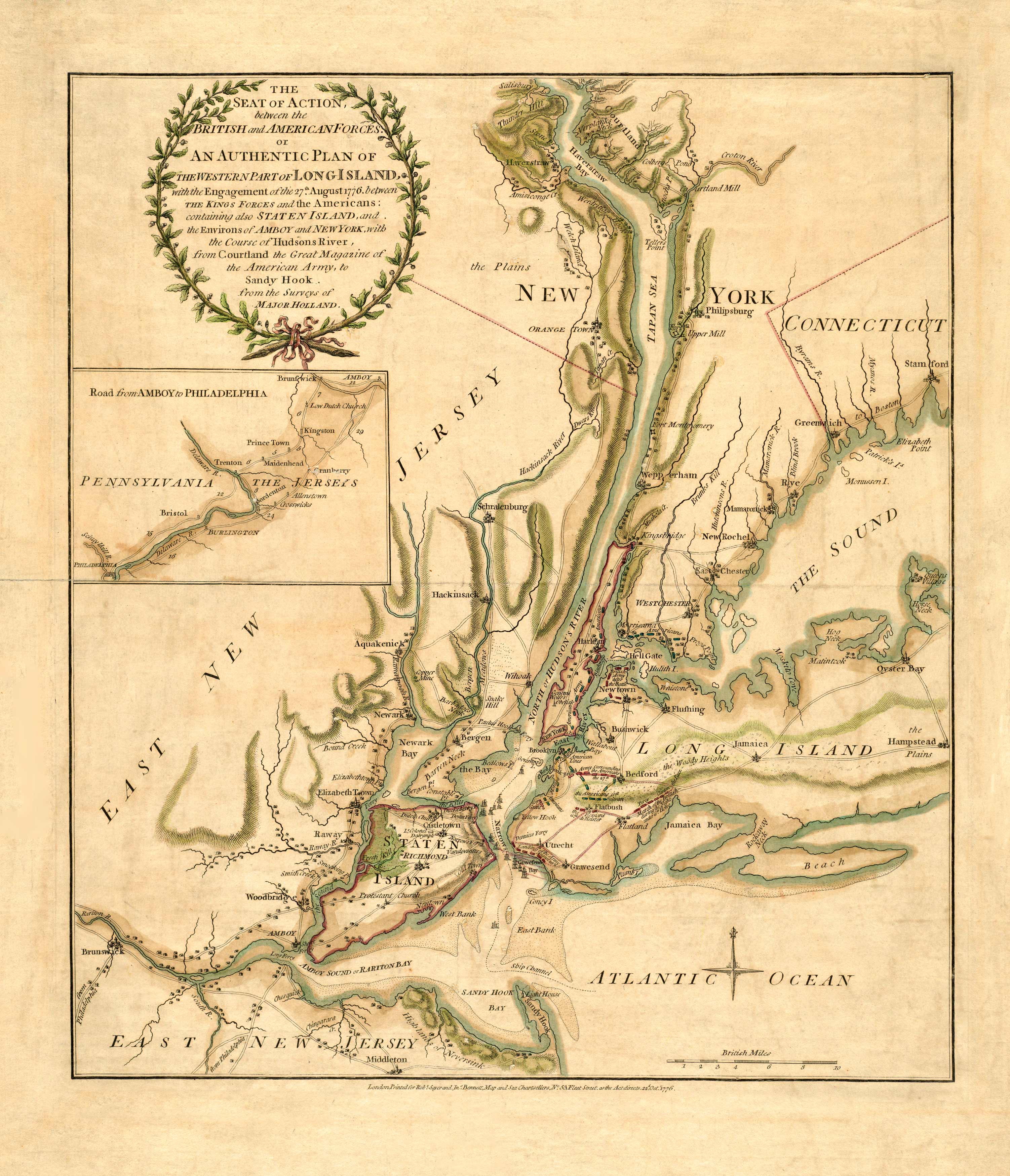
This military map shows the seat of action between the British and American forces in 1776. It shows Long Island, Staten Island, New York, New Jersey, and Connecticut. In the inset, the map features a road leading through Pennsylvania and the Jerseys, a road from Amboy to Philadelphia. American and British forces are depicted with red and gold lines. In Long Island, the map shows British forces surrounding the Americans. The March of the British during night is also shown. Staten Island is completely occupied by the British. Besides military action, the map names churches, bays, hills, mines, rivers, mills, and lighthouses.
Additional information
| Weight | 0.25 lbs |
|---|---|
| Dimensions | 21 × 18.23 × 0.002 in |
Map Maker: Holland, Samuel
Original Production Year: 1776
Original Production Year: 1776


