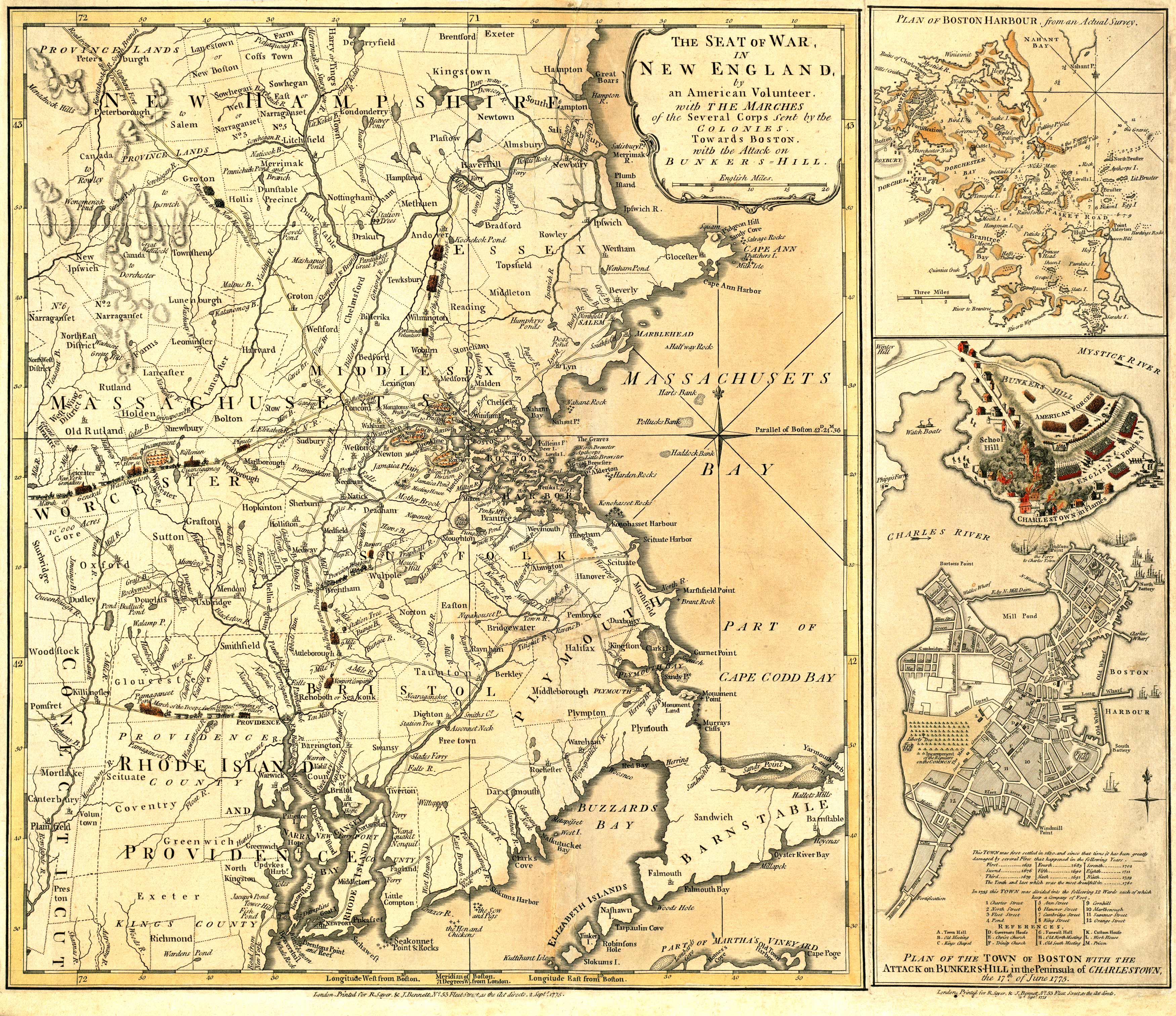
This map of New England is one the oldest and most accurately detailed pictorial accounts of the theater of war during the American Revolutionary War. Authored by an American volunteer,” it shows the march of General Washington’s army through Worcester, the troops from Connecticut, troops from Providence, the New York Grenadiers, and the Rangers from New Hampshire. Other interesting military details include depictions of provision wagons, a station tree, General Thomas’s division in Roxbury, and Walter’s meeting house. In the lower right inset, the map details the Boston Harbour; it provides a brief account of Boston fires from 1658 – 1760, references public buildings, and names streets. The Battle of Bunker Hill is depicted with Charlestown in flames. In the inset in the upper right corner, a plan of Boston Harbour is shown; this plan shows the numerous islands leading into Boston Harbour and Dorchester Bay. Besides capturing military detail, this map identifies key cities, bodies of water, county lines, hills, islands along the coast, and more. “
Additional information
| Weight | 0.25 lbs |
|---|---|
| Dimensions | 19 × 22 × 0.002 in |
Map Maker: Robert Sayer, John Bennett
Original Production Year: 1775
Original Production Year: 1775


