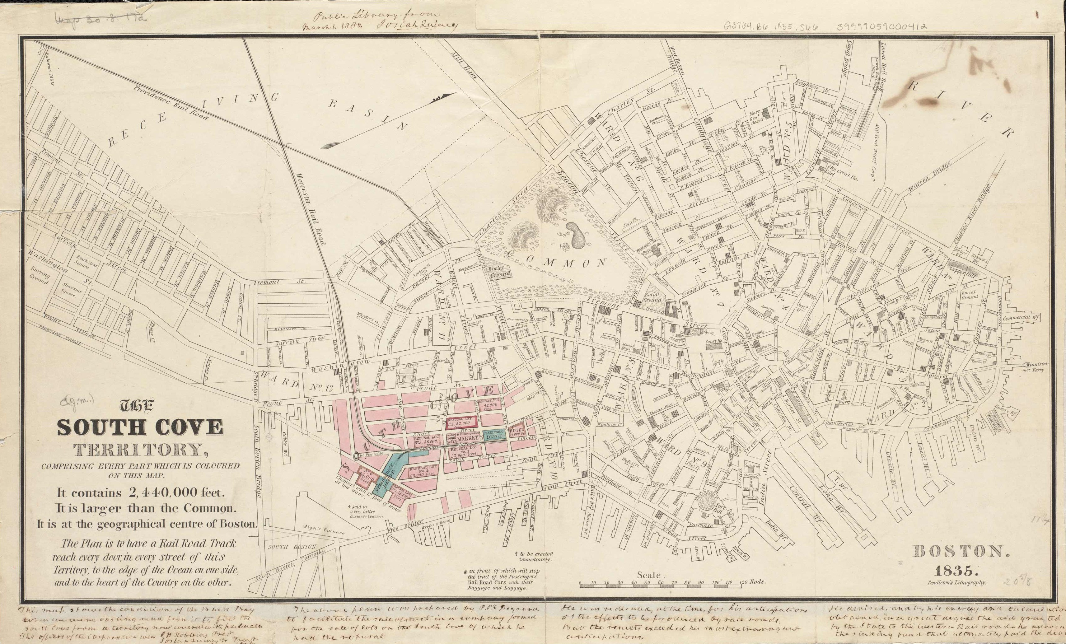
This map of the South Cove area shows plans for a railroad track that would reach to the edge of the Ocean one one side, and to the heart of the Country on the other.” This map shows the Boston area in 1835. It names streets, ferries, gardens, cemeteries, the hospital, hotels, markets, the train depot, and more. “
Additional information
| Weight | 0.25 lbs |
|---|---|
| Dimensions | 16 × 29 × 0.002 in |
Map Maker: Unknown
Original Production Year: 1835
Original Production Year: 1835


