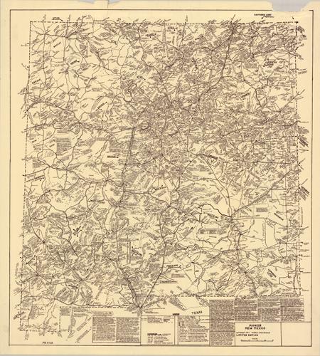
Researched and drawn by the famous map artist, Perry C. Van Arsdale, this map of Pioneer New Mexico was published in 1971. Perry produced a series of 9 hand-drawn and hand-lettered maps over a 15-year period that depicts the United States of America in the 20th century. He would research by gathering his materials and family to visit the people and places in person, and upon returning, he followed up by verifying the accounts in town and court records. Each map took at least 2 years to research and draw. He illustrates towns, roads, trails, railroads, highways, mountains, valleys, as well as including numerous historical facts and notes about the people, places, and environment.
Additional information
| Weight | 0.25 lbs |
|---|---|
| Dimensions | 35.25 × 31.75 × 0.002 in |
Town Name: NEW MEXICO
Map Maker: Perry C. Van Arsdale
Original Production Year: 1971
Year: 1971
Map Maker: Perry C. Van Arsdale
Original Production Year: 1971
Year: 1971


