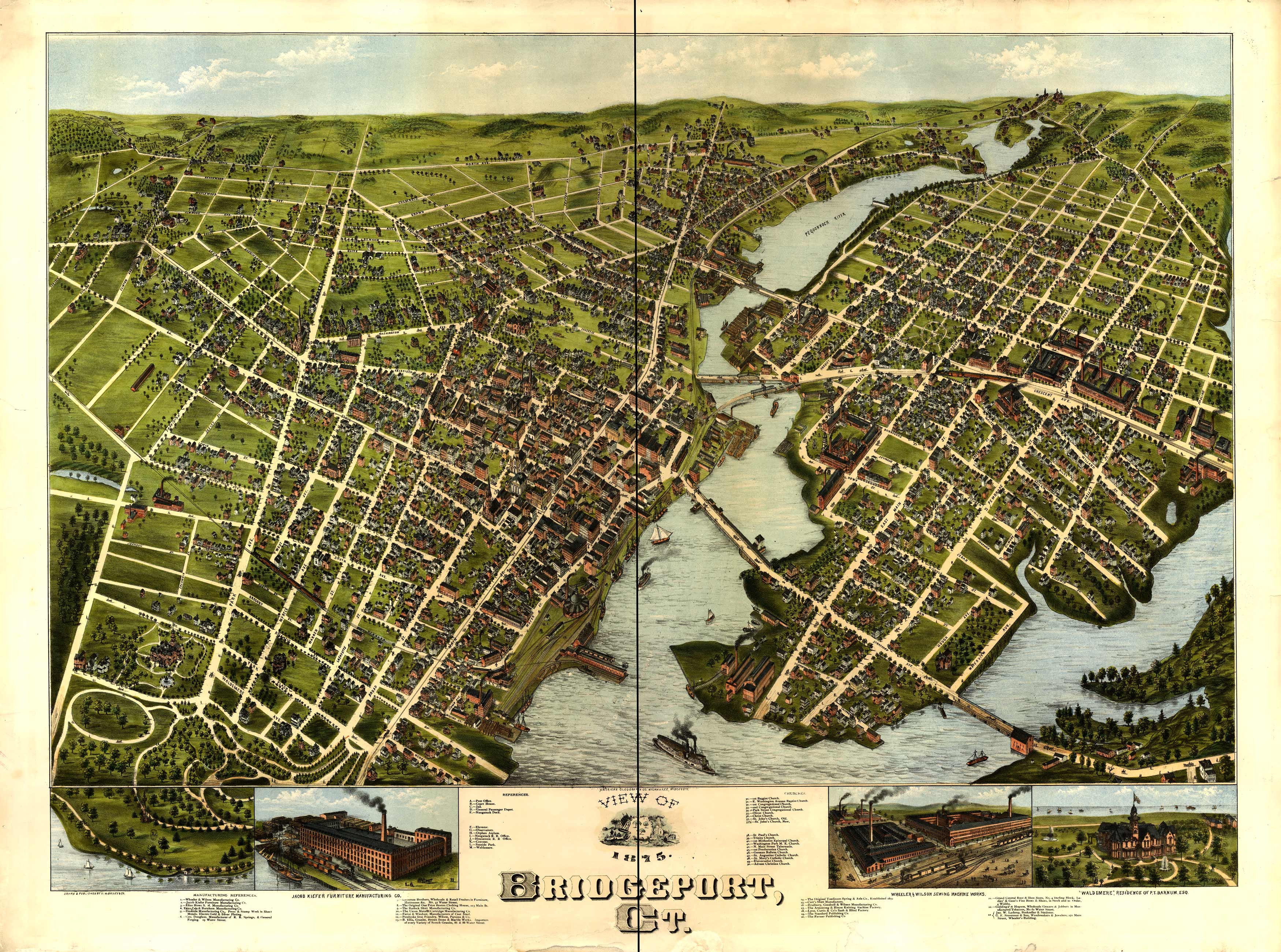
This is a nicely colored bird’s eye view reproduction map of Bridgeport, Connecticut from 1875. It shows the harbors and river close to Bridgeport.
Additional information
| Weight | 0.25 lbs |
|---|---|
| Dimensions | 17.8 × 24 × 0.002 in |
Map Maker: O.H. Bailey & Co
Original Production Year: 1875
Original Production Year: 1875


