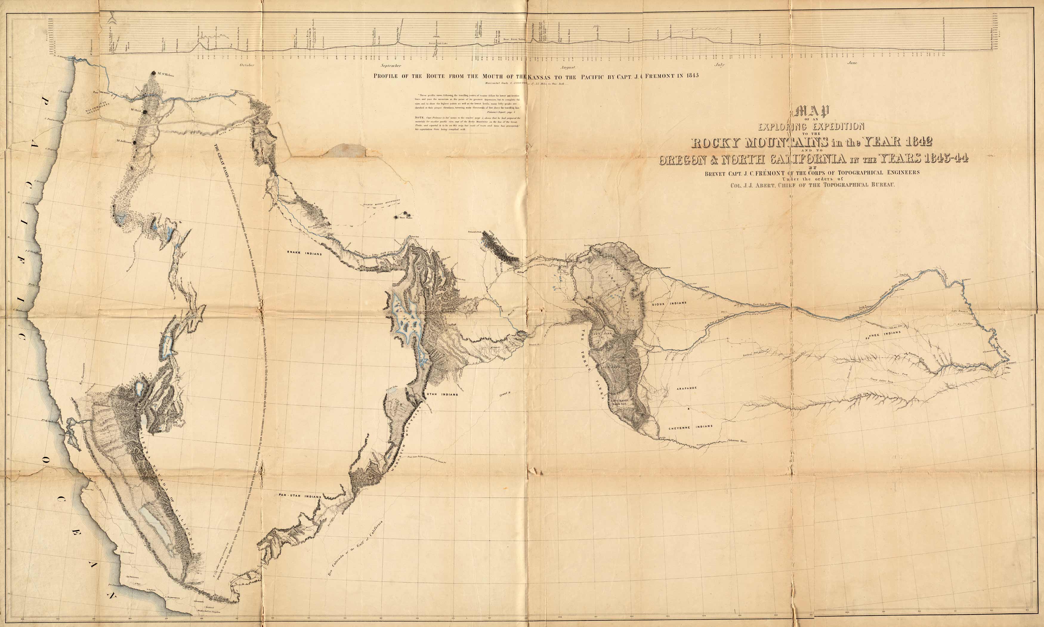
The original of this map is rare and highly sought after because of it’s importance to the exploration of the West. Originally done in 1845 during the famous Fremont expedition, this map charts the rivers and mountains of the West. This map is one of the most interesting and beautiful government maps of the 1840’s. It filled in many of the gaps in cartographic knowledge of the west. Charles Preuss was the cartographer. It begins at the Missouri River in Kansas and crosses the country to the Western coastline.
Additional information
| Weight | 0.25 lbs |
|---|---|
| Dimensions | 31.84 × 53 × 0.002 in |
Map Maker: John Charles Fremont
Original Production Year: 1845
Original Production Year: 1845


