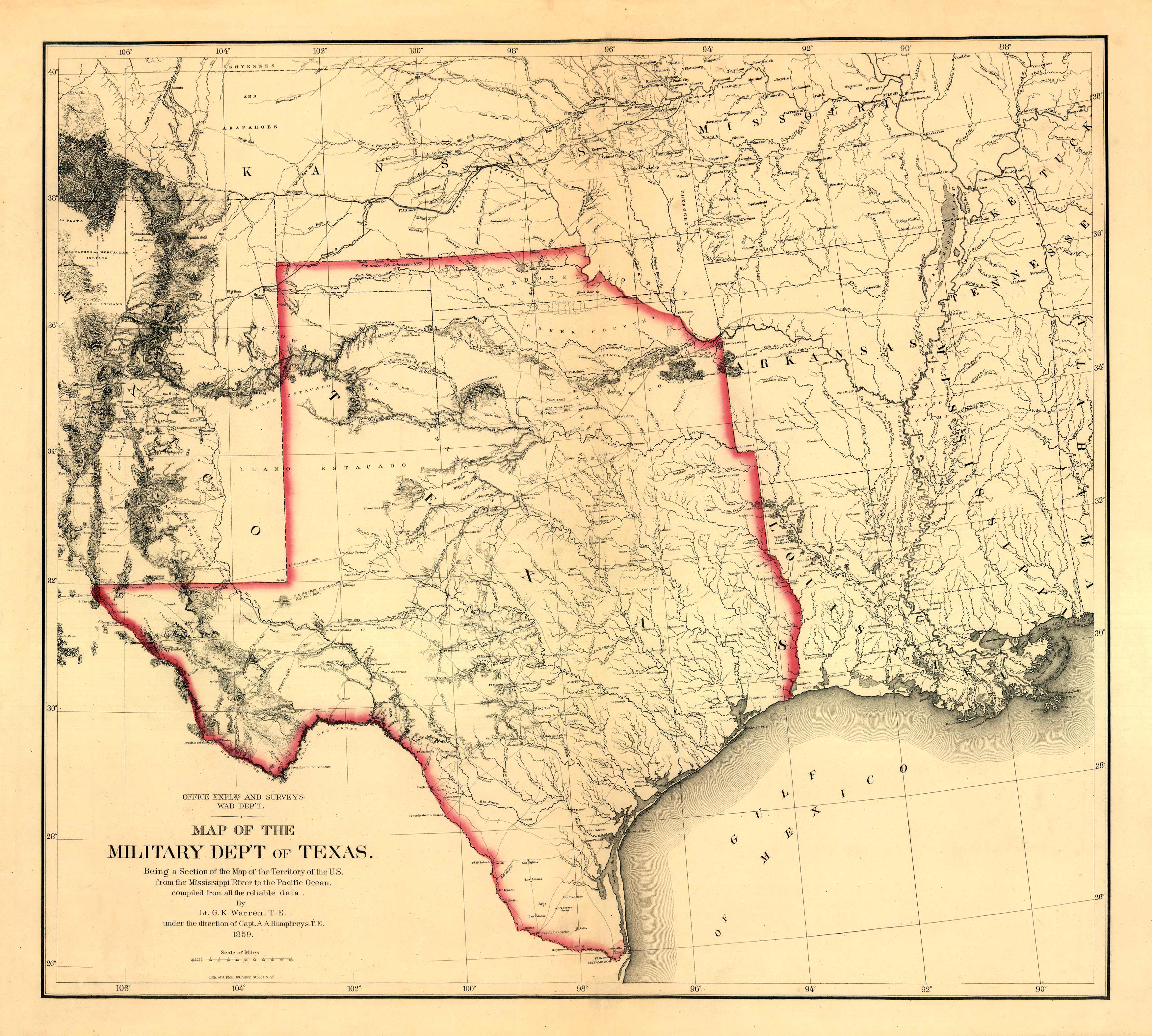
This 1859 map by G. K. Warren, A. A. Humphreys and Julius Bien shows with the expanse of Texas along with the locations of military posts, specific Indian tribes, and routes and dates of expeditions and surveys. The historic piece goes as far north as Kansas and Missouri and as far east as Alabama. Everything west of Texas is shown as Mexico.
Additional information
| Weight | 0.25 lbs |
|---|---|
| Dimensions | 22 × 25 × 0.002 in |
Map Maker: G. K. Warren, A. A. Humphreys, Julius Bien
Original Production Year: 1859
Original Production Year: 1859


