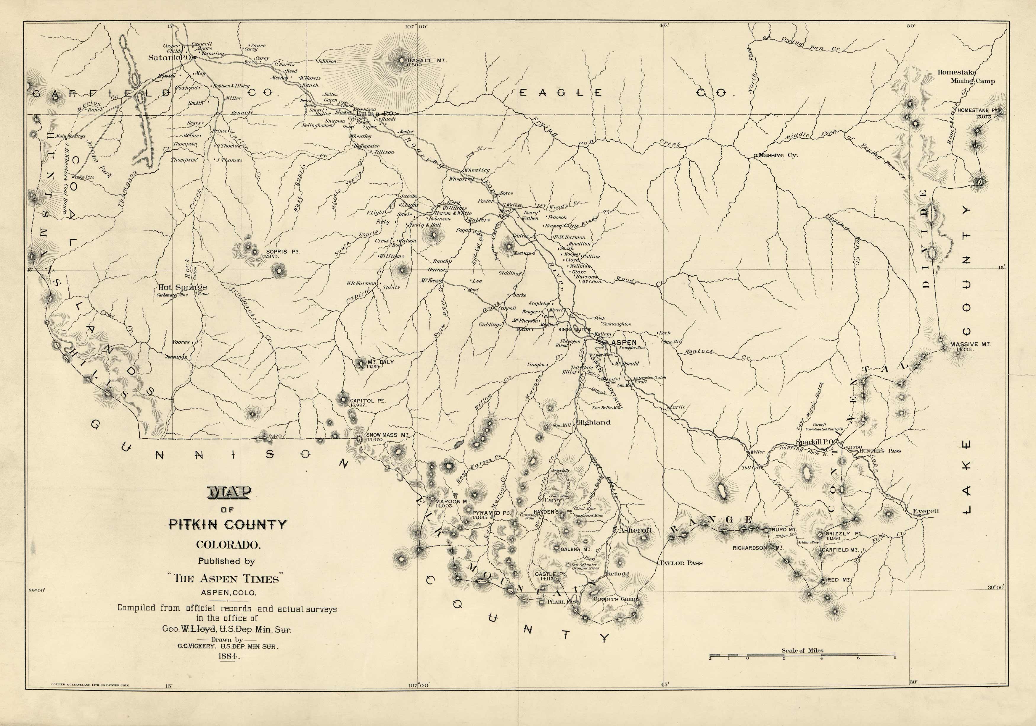
This map of Pitkin County, Colorado was compiled by surveys and official records from the office of George Lloyd, U.S. Department of Mineral Surveys, and was drawn by G.C. Vickery from the same department. It was published by the Aspen Times in 1884. This map shows landowners, rivers, creeks, hot springs, mountains as well as elevations. Relief shown by hachures.
Additional information
| Weight | 0.25 lbs |
|---|---|
| Dimensions | 14 × 20 × 0.002 in |
Map Maker: G.C. Vickery
Original Production Year: 1884
Original Production Year: 1884


