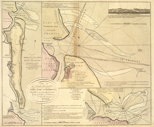
This 1770 nautical chart by William Fuller depicts Amelia Island, Cumberland Island, and the Nassau River.It provides sounding information, bar locations, sailing directions, and more. Numerous islands, channels, and banks are identified. Notorious with pirates, slave owners, and smugglers, Amelia Island was a popular sailing harbor in the 18th century. In the inset in the top right corner, a view of St. Mary’s River is provided. Some settlements along Amelia Island are shown.
Additional information
| Weight | 0.25 lbs |
|---|---|
| Dimensions | 23 × 28 × 0.002 in |
Map Maker: Fuller, William
Original Production Year: 1770
Original Production Year: 1770


