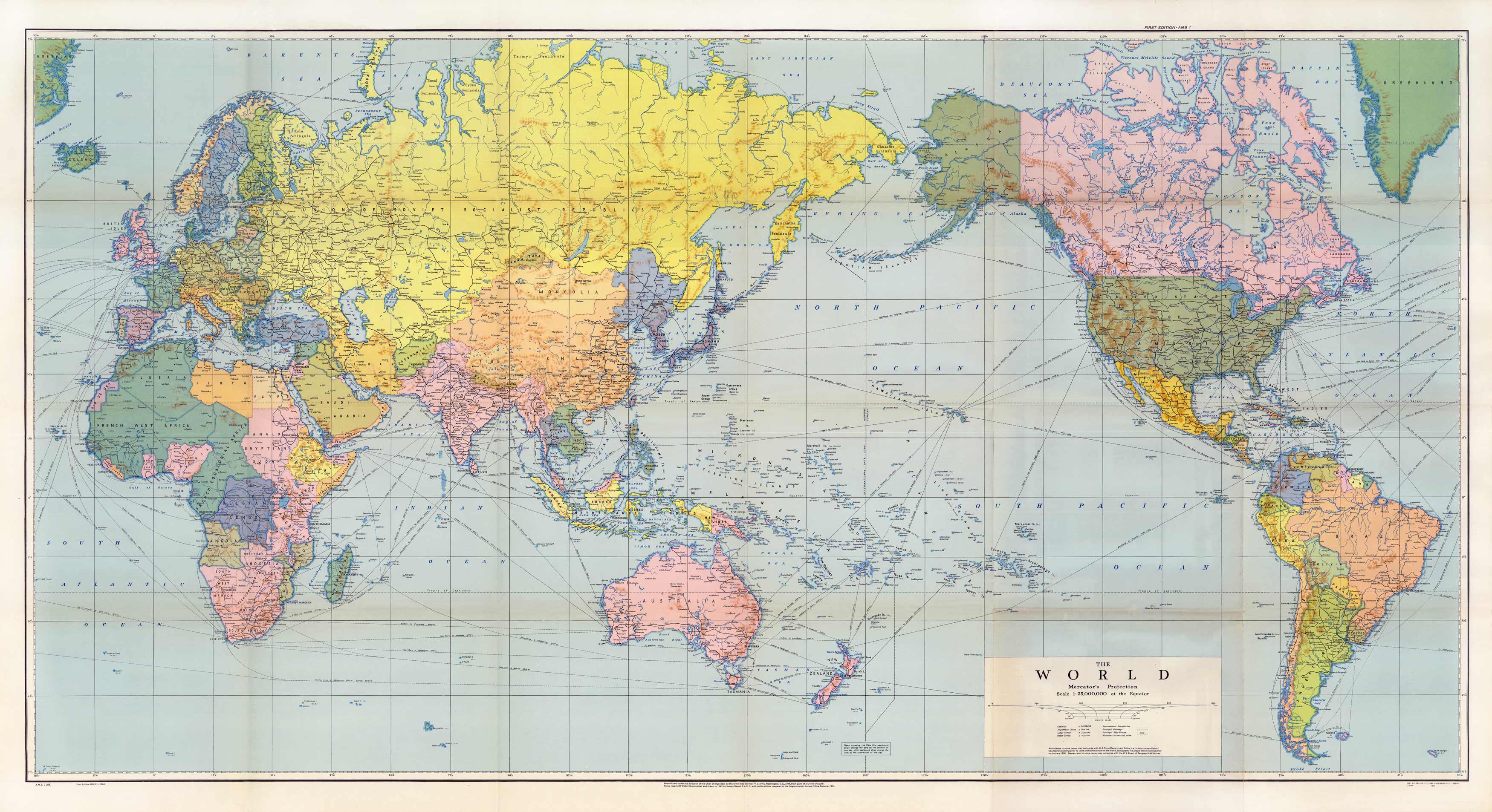
This colorful World Mercator’s Projection map was done in 1943 by the Survey Depot and Army Map Service. It shows a variety of ship routes, time zones, principal railways, international boundaries and distance in nautical miles between cities and countries.
Additional information
| Weight | 0.25 lbs |
|---|---|
| Dimensions | 19 × 36 × 0.002 in |
Map Maker: Army Map Service, Survey Depot
Original Production Year: 1943
Original Production Year: 1943


