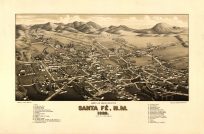
This aerial map by O.H. Bailey and C.J. Hazen shows Warren, Rhode Island as it was in 1877. It shows the names of specific streets such as Baker, Warren, Union, and North Water. It also provides the locations of various churches, the post office, the high school, the cement/lumber dealer, the coal/wood/flour/grain dealer, and more. The map also lays out geographic information, railroads, and cemeteries. Warren River and Belcher’s Cove are also captured.
- Invalid Image Size
Additional information
| Weight | 0.25 lbs |
|---|---|
| Dimensions | 20 × 27.5 × 0.002 in |
Map Maker: O.H. Bailey, C.J. Hazen
Original Production Year: 1877
Original Production Year: 1877


