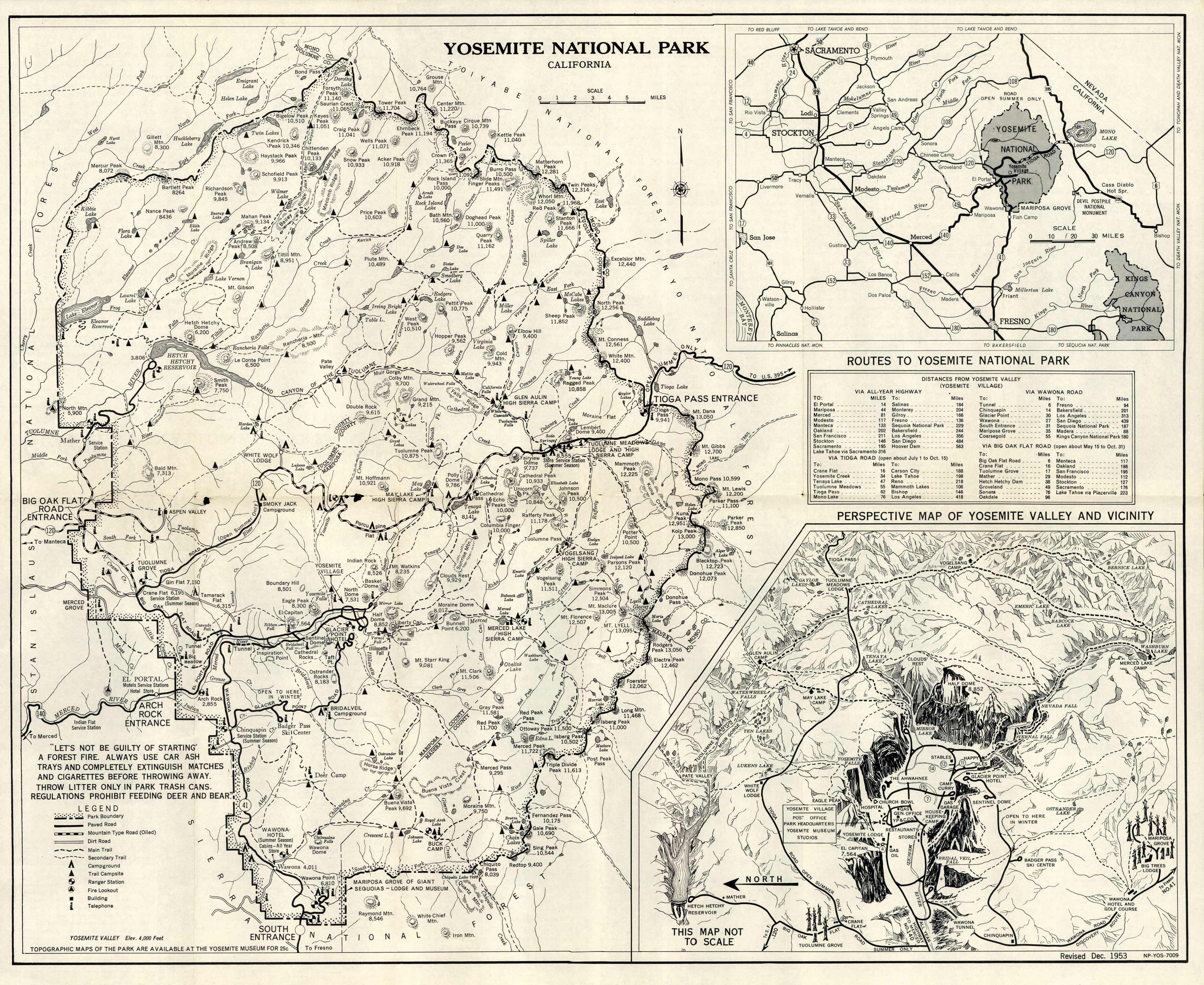
This 1953 topographical map shows Yosemite National Park in California. This map shows old locations of park boundaries, paved roads, fire lookouts, campgrounds, trail campsites, ranger cottages, and main/secondary trails. Yosemite Village is also depicted with stores, restaurants, a lodge, hospital, and church bowl; a table indicating routes to multiple cities from Yosemite Village is represented just above. Above the map legend, the map reads, Let’s not be guilty of starting a forest fire. Always use car ash trays and completely extinguish matches and cigarettes before throwing away. Throw litter only in park trash cans. Regulations prohibit feeding deer and bear.””
Additional information
| Weight | 0.25 lbs |
|---|---|
| Dimensions | 18 × 23 × 0.002 in |
Map Maker: Washington, D.C. : Interior--Geological Survey
Original Production Year: 1953
Original Production Year: 1953


