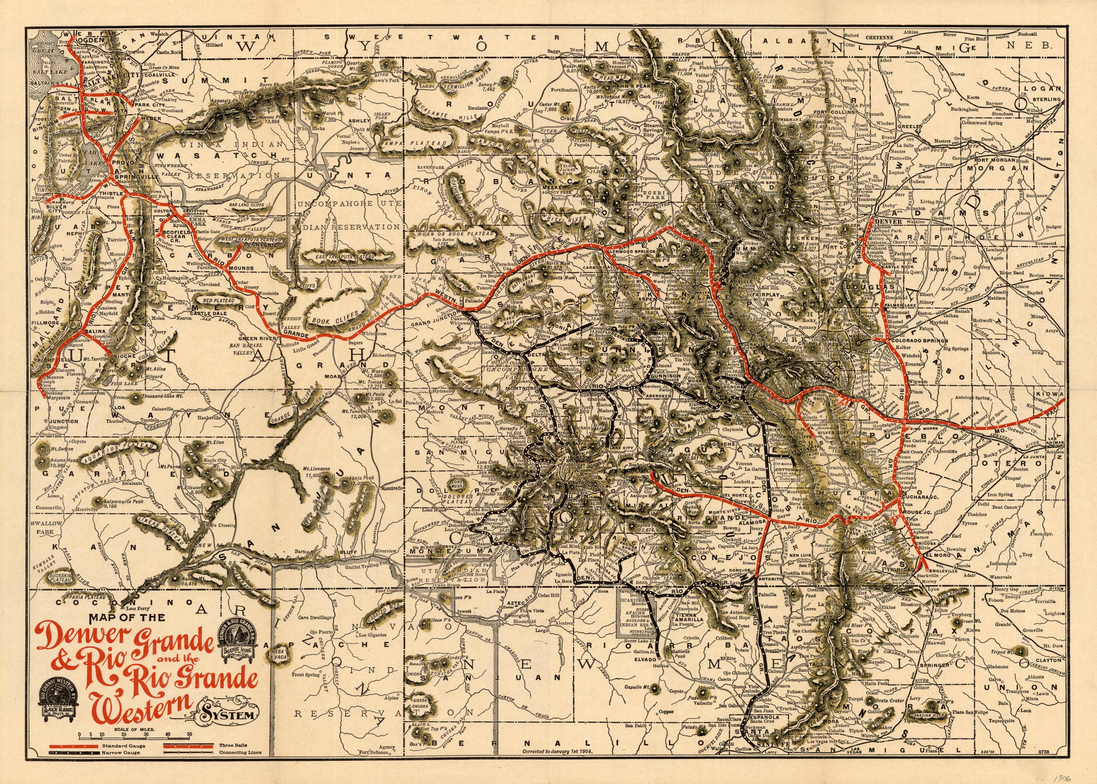
This map shows us the progress of the Denver and Rio Grande railroad, but more so it shows the great development and expansion of the West. Covering an area from as far west as Salt Lake City and as far east as Denver and the plains, this map shows us general topography and scads of the small towns that were springing up in the mountains and along the rail lines. Condition is very good.


