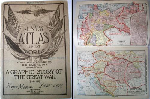
A New Atlas of the World Corrected According to the Peace Terms Together with A Graphic Story of The Great War 1914-1919
Out of stock
This is a great book filled with historical and geographical information about the Great War, or whats now referred to as WWI. Published by Frank F. Lovell and written by Merton M. Wilner, this atlas is packed with details about the Great War. The maps within this atlas are from all over the world and some show red overprint of the changing boundaries that were affected by the war. The text provides a detailed accounts of the war during each year, from 1914 – “When the Lid Blew Off” to 1919 – “Making a New World”. The beginning of the book contains a chronology that lists the events of the war by day. This book would be great for any history buff or anyone interested in learning more about the Great War. It is filled with factual and interesting notes on the war and specific dates. This book is in great condition with the cover intact. (The image shows the front cover and the inside with two maps, Germany and Czecho-Slovakia.)’
Condition: Very Good, light age toning
Map Maker: Frank F. Lovell/Merton M. Wilner
Coloring: Printed Color
Year: 1919
Out of stock


