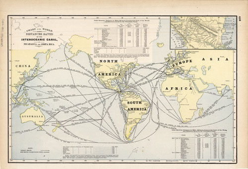
Chart of the World Showing Distances Saved by the Interoceanic Canal
In stock
This map is from the extremely rare and well maintained 1892 edition of the county and railroad atlas published by George F. Cram. Crams distinctive title plates, coloring, and topographical details found on the maps in this hard to find 1892 atlas make them outstanding collectible pieces.
Size: 16 x 12 inches
Condition: Excellent - minor age toning at edges
Map Maker: George F. Cram
Coloring: Printed Color
Year: 1892
Condition: Excellent - minor age toning at edges
Map Maker: George F. Cram
Coloring: Printed Color
Year: 1892
In stock


