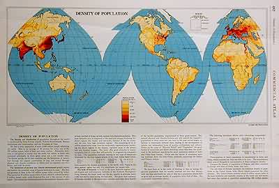
Density of Population
In stock
The 1936, sixty-seventh edition of the “Rand McNally Commercial Atlas and Marketing Guide” is unique in its inclusion of informative details concerning population sizes, district uses, the size of counties, and railroad routes. This map shows the concentration of the population around the world. The text below the map provides more information on the density of population.
Size: 19 x 12.5 inches
Condition: Very Good-age toning, small tears in margin, tear at edge of map, crease across map
Map Maker: Rand McNally & Co.
Coloring: Machine Color
Year: 1936
Condition: Very Good-age toning, small tears in margin, tear at edge of map, crease across map
Map Maker: Rand McNally & Co.
Coloring: Machine Color
Year: 1936
In stock


