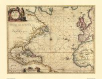
This old world map was created by John Bartholomew around 1850. John George Bartholomew was born in Edinburgh, educated at the University of Edinburgh and entered the family map business in the early 1880s. The company shared premises with Thomas Nelson’s printing works until 1911, when ‘The Edinburgh Geographical Institute’ moved to Duncan Street in Edinburgh’s Newington district. Bartholomew is best remembered for his sense of colour harmony which brought him to design an innovative system for layer colouring, involving deepening blues with water depth and a transition from green to buff to white for increasing height of the land. This was first used in his noted Survey Atlas of Scotland (1895), extensively used in the Half Inch Map of Britain and is now widely seen on maps and in atlases across the world. Bartholomew was appointed ‘Cartographer Royal’ by King George V in 1910.
Additional information
| Weight | 0.25 lbs |
|---|---|
| Dimensions | 20 × 24 × 0.002 in |
Map Maker: John Bartholomew
Original Production Year: ca. 1850
Original Production Year: ca. 1850


