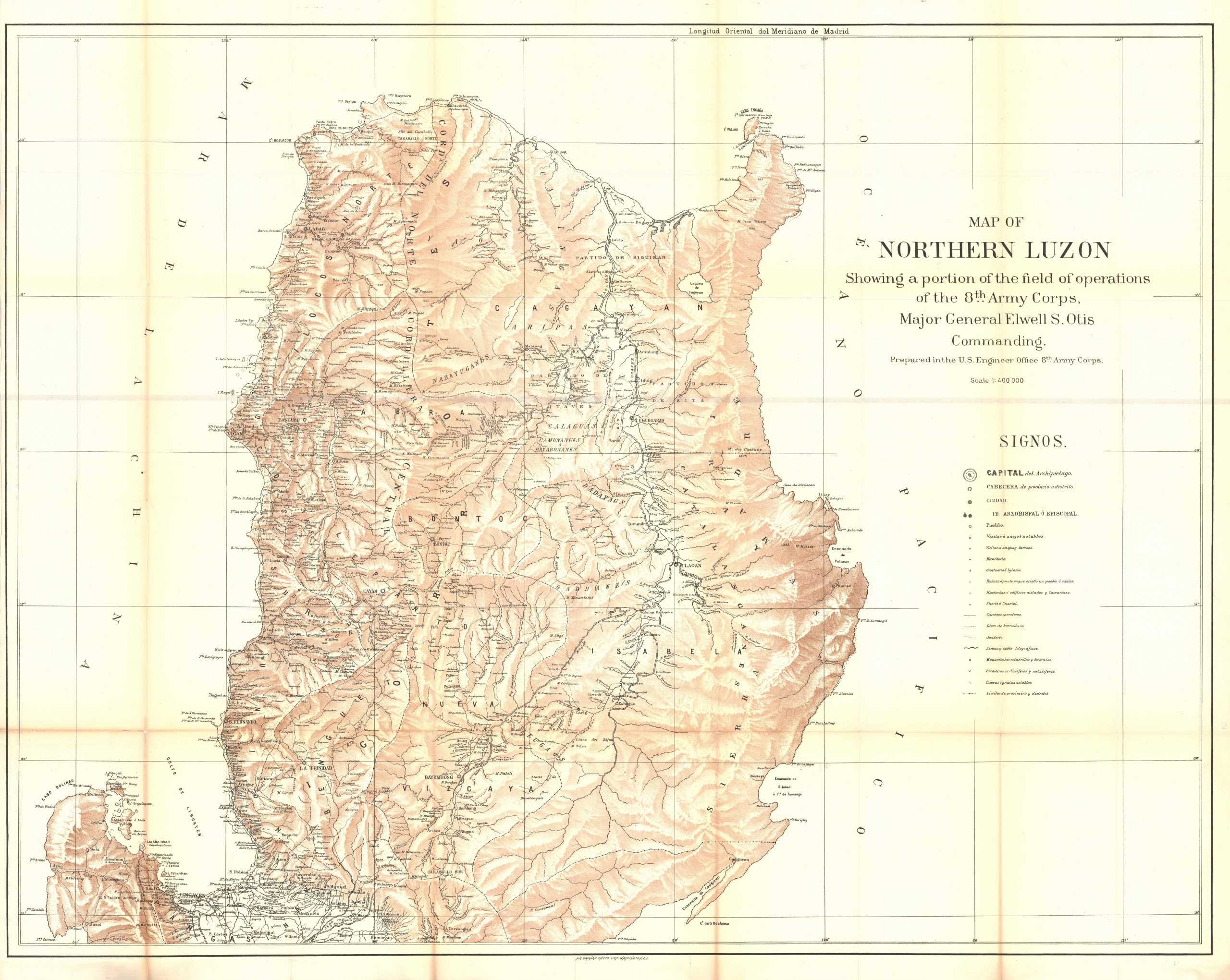
Map of Northern Luzon, Philippines
In stock
Rare map of Northern Luzon showing a portion of field operations of the 8th Army Corps, Major General Elwell S. Otis Commanding. This map is extremely rare and may be the largest and most detailed map to be published during the Philippine-American War (1899 – 1902) . This large-scale map depicts the Northern part of Luzon from the gulf of Lingayen and Pangasinan North to Cabo Engano and Pta. Mayraira. The area of Pta. Mayraira, at the tip of Northern Luzon, was controlled primarily by Philippine forces at the time of the war. This detailed map showcases roadways, cities, telegraph lines, political boundaries and topography of the land.
Size: 43 x 34 inches
Condition: Extremely good condition. There is slight age toning at some of the folds and a couple of minor tears in the bottom fold.
Original Production Year: 1900
Coloring: Chromolithography
Year: 1900
Condition: Extremely good condition. There is slight age toning at some of the folds and a couple of minor tears in the bottom fold.
Original Production Year: 1900
Coloring: Chromolithography
Year: 1900
In stock


