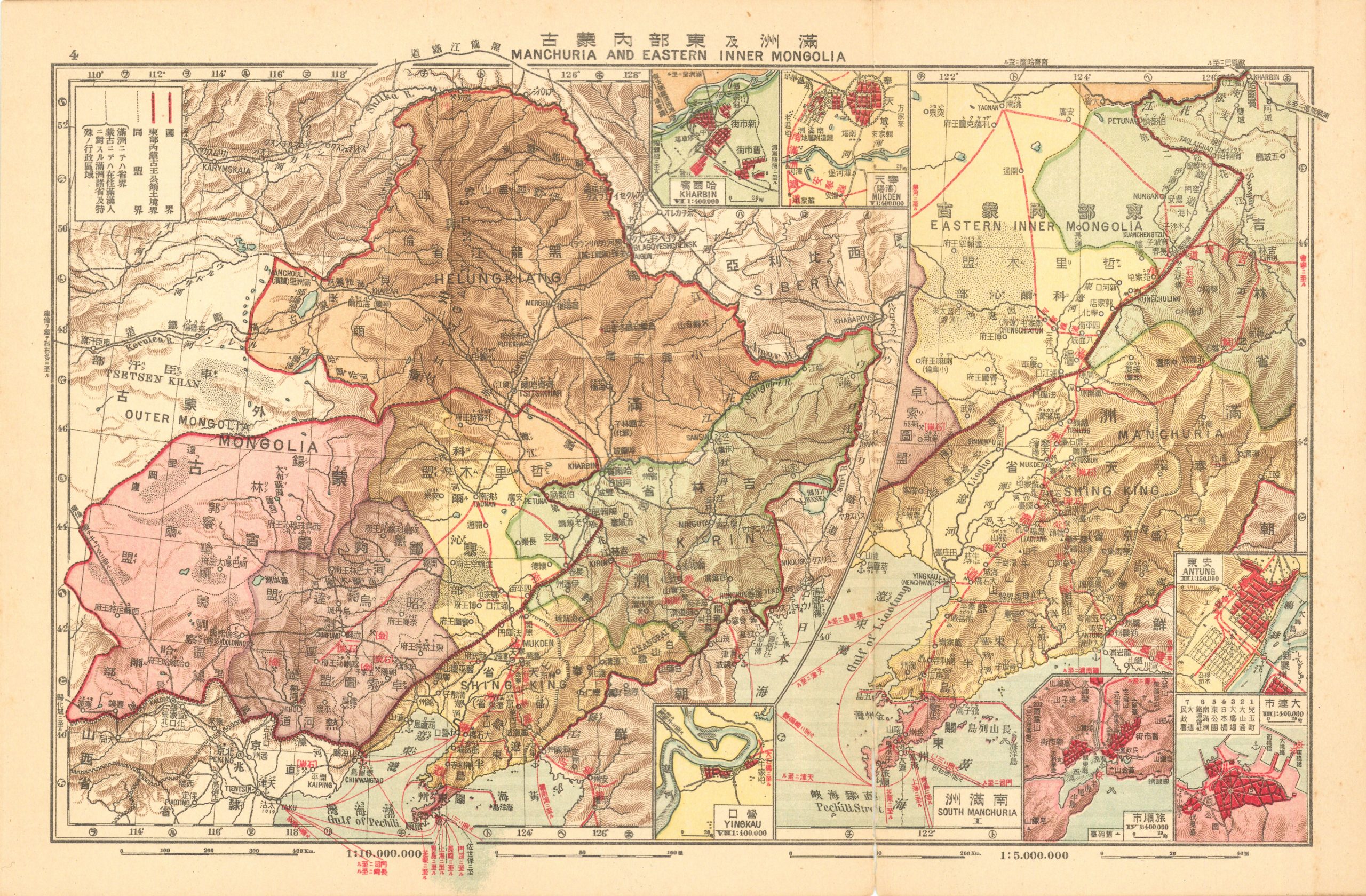
Kaiseikwan’s 1920 Map of Manchuria and Eastern Inner Mongolia
Out of stock
In our over 40 years in the antique map business this is one of the only Japanese language maps we have ever offered. This map of Manchuria and Eastern Inner Mongolia was produced by Tokyo Keiseikan in March of 1920 as part of Kaiseikwan’s Standard Atlas of Japan.
Size: 7 x 11 inches
Condition: Excellent
Map Maker: Tokyo Kaiseikan
Original Production Year: 1920
Coloring: Printed Color
Year: 1920
Condition: Excellent
Map Maker: Tokyo Kaiseikan
Original Production Year: 1920
Coloring: Printed Color
Year: 1920
Out of stock


