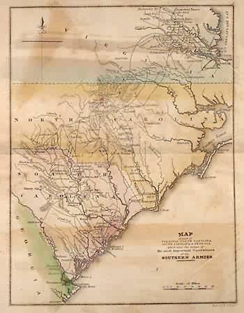
Revolutionary War Map of part of Virginia, North Carolina, South Carolina and Georgia which were the scenes of the most important Operations of the Southern Armies, 1776, (1850)
Out of stock
This map, produced in 1850, documents important battles of the Revolutionary War as supplements to the “Atlas to Marshall’s Life of Washington”. These rare and historically important maps have light pastel hand coloring on well aged paper. Each map has abundant details, including relevant locations and illustrations representing ships and armies distinguished by color. The title of the map includes an explanation of the area shown and the date of the significant event depicted. This map is titled “Map of Part of Virginia, North Carolina, South Carolina & Georgia which were the scenes of the most important Operations of the Southern Armies”. State boundaries have been changed since this map was made. These small maps would look very nice framed, and make great additions to the collection of anyone interested in the revolutionary war or local history.
Condition: Very Good-age toning, light off-setting
Map Maker: J. Crissy
Original Production Year: 1776
Coloring: Hand Color
Year: 1850
Out of stock


