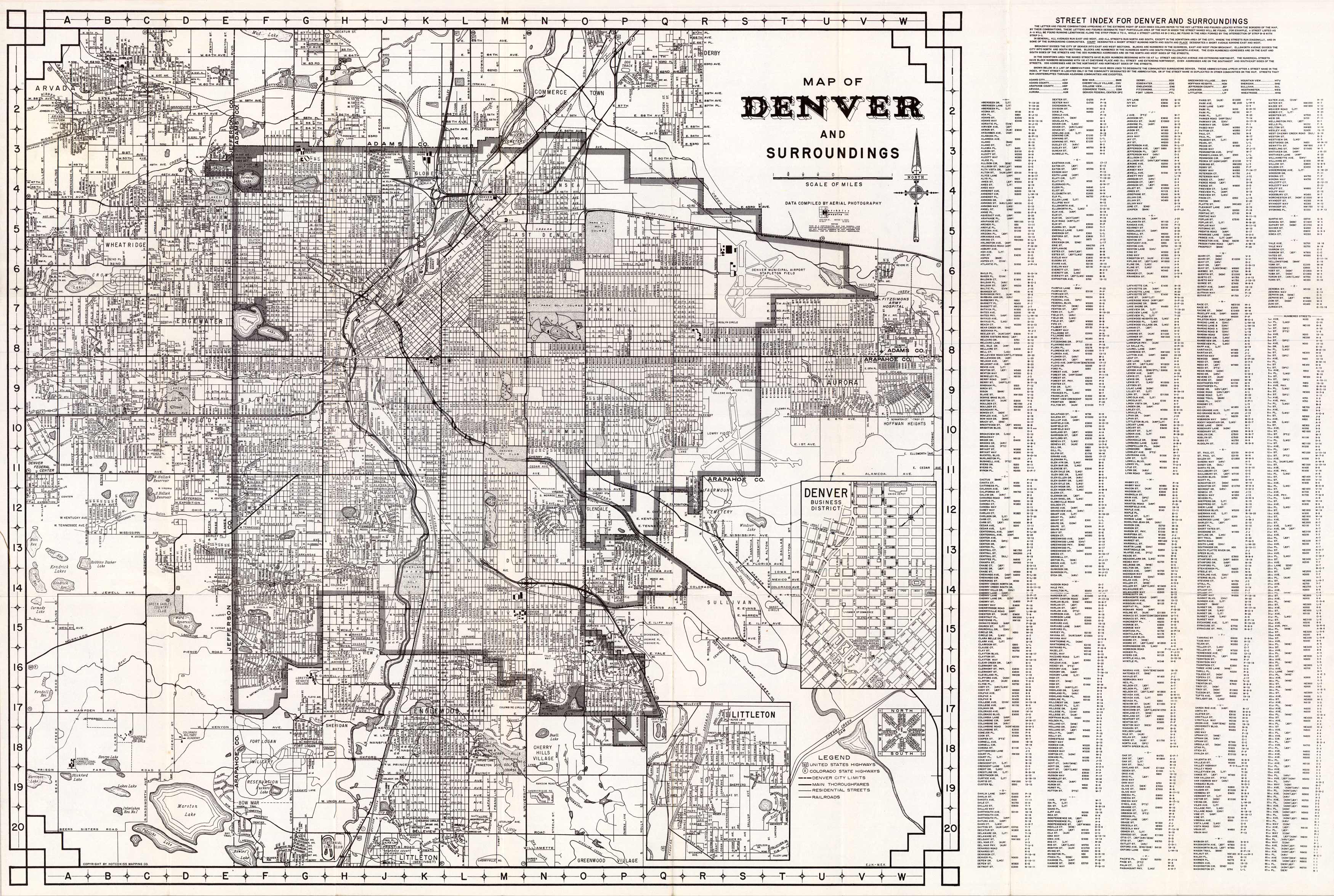
This detailed map of Denver identifies lakes, street names, golf courses, railroad lines, the Fort Logan military reservation, the Denver University Stadium and Field House, and more. It extends as far west as Arvada, as far north as Commerce Town in Adams County, as far east as Hoffman Heights in Aurora, and as far south as the Centennial Turf Club in Littleton. The inset shows street names and public buildings in Littleton and Denver’s Business District.
Additional information
| Weight | 0.25 lbs |
|---|---|
| Dimensions | 18 × 27 × 0.002 in |
Map Maker: Hotchkiss Mapping
Original Production Year: 1960
Original Production Year: 1960


