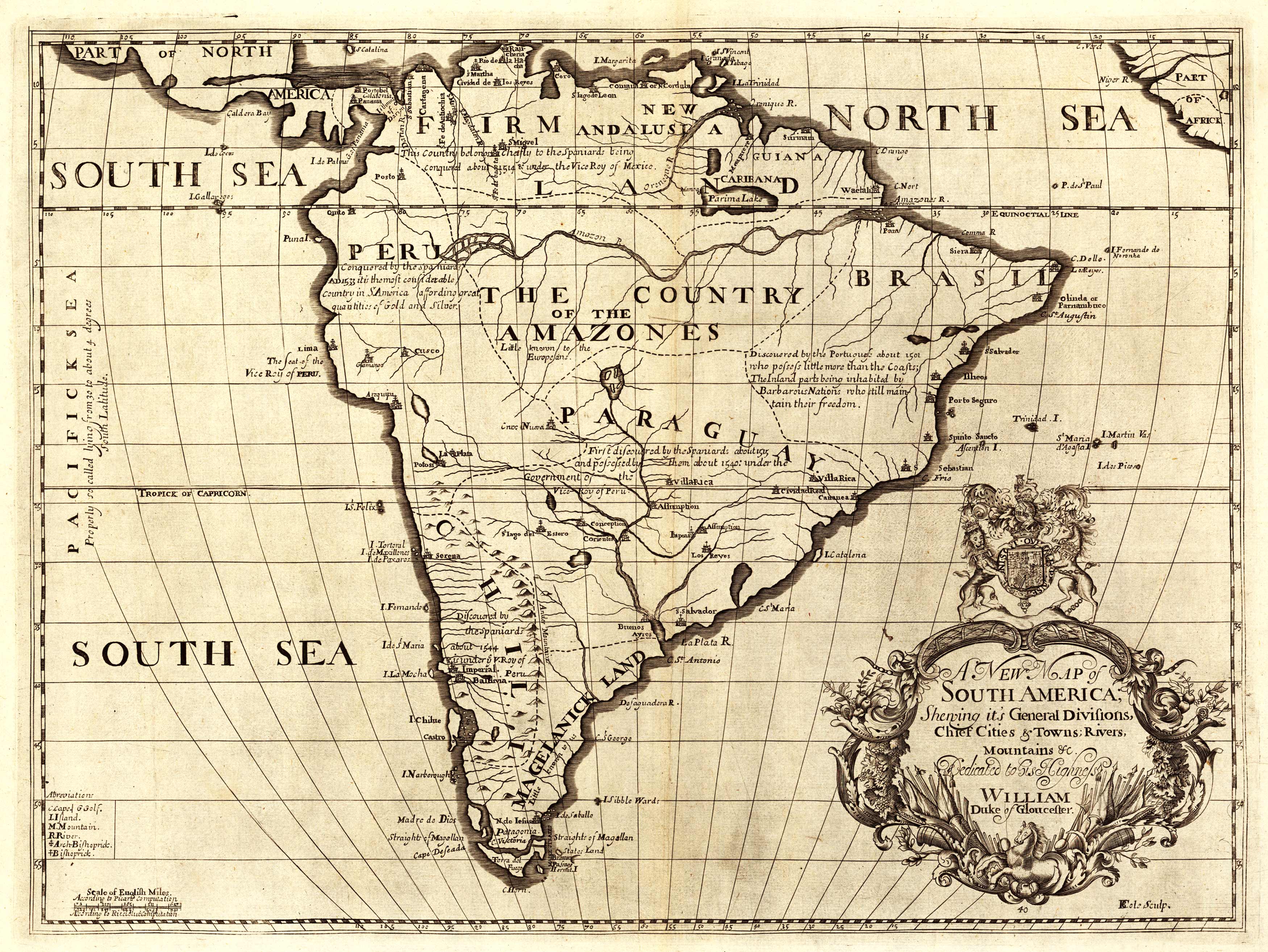
This 1700 map by Edward Wells depicts South America. It contains notes about explorations of each area, such as that under Peru, Conquered by the Spaniards A.D. 1533 it is the most considerable country in S. America affording great quantities of Gold and Silver.” Underneath the “Country of the Amazones,” it reads, “Little known to Europeans.” Different cathedrals are labeled throughout the map, such as St. Lago del Estero (present-day Santiago del Estero). The map only names Peru, Paraguay, Brazil, and Chili. Some mountains, rivers, and islands are shown.”
Additional information
| Weight | 0.25 lbs |
|---|---|
| Dimensions | 22 × 30 × 0.002 in |
Map Maker: Edward Wells
Original Production Year: 1700
Original Production Year: 1700


