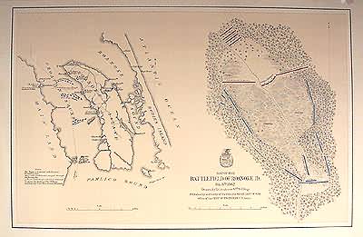
Map of the Battlefield of Roanoke ID.
In stock
Art Source is proud to showcase a stunning collection of original Civil War plans and maps. These large scale, steel engraved maps are extremely rare, and difficult to find. We have not seen a collection like this in years. Each map’s significant detail shows towns, wagon roads, railroads and proposed railroads, landowners, farms, rivers, lakes, streams, topography and physical features of the land and forts. This map of the battlefield of Roanoke illustrates troop locations of the Union and Confederate Army forces, which are marked in red and blue. Noted on the map: Fort Hunger is furnished with furnaces for heating shot. Many of the Confederates escaped through Shallowbag Bay. Two hundred Troops with 2 Guns stationed to opposes the landing of the U.S. Forces dispersed by Shells from Gunboat Delaware.
Condition: Very Good
Map Maker: U.S. Government
Coloring: Outline Color
Year: circa 1860
In stock


