 |
||
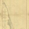
Coast Chart No. 121 – From Sandy Hook to Barnegat Inlet – New Jersey
Out of stock
This coastal survey was printed by the U.S. Coast and Geodetic Survey Office in Washington D.C. Details include the names of cities and waterways along the coast. Depth soundings are shown in fathoms. Other details that may be included are lighthouses and buoy positions.
Size: 30.5 x 38.5 inches
Condition: Fair - uneven age toning, folds, creases, staining, distressed paper, pen and pencil markings
Map Maker: U.S. Coast and Geodetic Survey
Coloring: Black & White
Year: 1903
Condition: Fair - uneven age toning, folds, creases, staining, distressed paper, pen and pencil markings
Map Maker: U.S. Coast and Geodetic Survey
Coloring: Black & White
Year: 1903
Out of stock