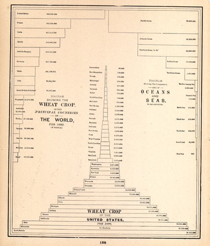
Diagram showing the Wheat Crop of the Principal Countries of the World, for 1890, the Comparative Area of Oceans and Seas, and Wheat Crop of the United States for 1890.
In stock
This diagram was originally published in the very hard to find Colombian Worlds Atlas. This atlas was published by the Chicago-based George F. Cram company to commemorate the 1893 World’s Fair and Colombian Exposition.
Size: 10 x 12 inches
Condition: Excellent
Map Maker: George F. Cram
Coloring: Black and White
Year: 1893
Condition: Excellent
Map Maker: George F. Cram
Coloring: Black and White
Year: 1893
In stock


