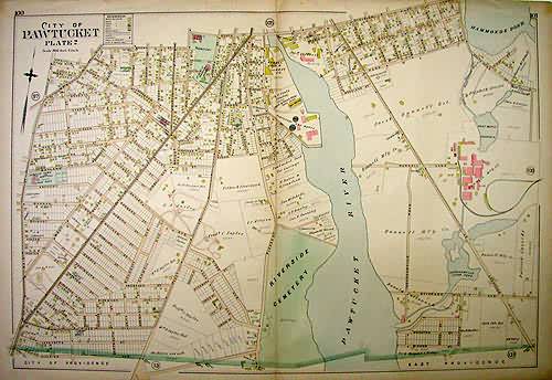
City of Pawtucket, Plate 2
In stock
We are proud to offer this map of the city of Pawtucket, Rhode Island, published by Everts and Richards in their “Atlas of Rhode Island” in 1895. These fine, large-scale maps show buildings, large property owners, roads, railroads, public buildings, bridges, stage lines, electric car lines, churches, which buildings were wood, brick or stone, barns, stables, icehouses, telegraph offices , and fire houses. These maps offer an amazing look at turn of the century Rhode Island towns.
Size: 30 x 22 inches
Condition: Good - age toning
Map Maker: Everts and Richards
Coloring: Original Hand Color
Year: 1895
Condition: Good - age toning
Map Maker: Everts and Richards
Coloring: Original Hand Color
Year: 1895
In stock


