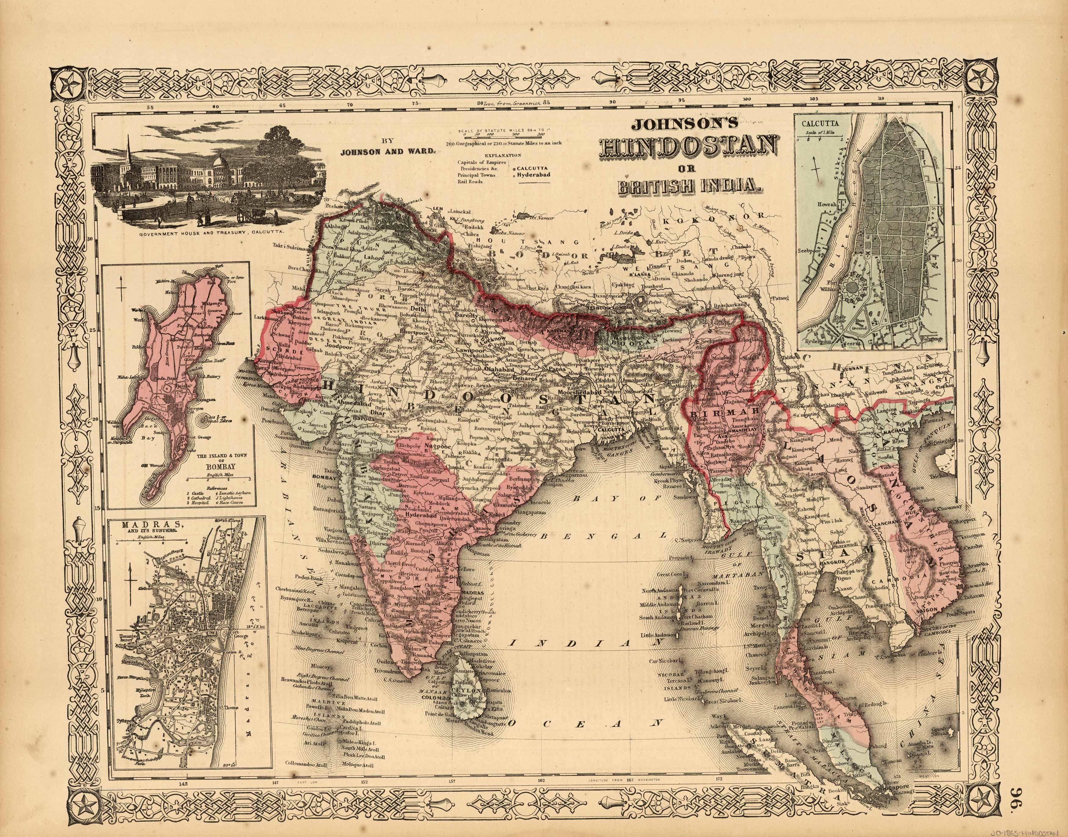
Johnson’s Hindostan or British India
In stock
This finely detailed map came from Johnson’s New Illustrated (steel Plate) Family Atlas. Map shows cities and towns, rail lines, rivers and lakes, and wagon trails/roads. Each region is individually colored, and includes the traditional decorative border. Includes depictions of Calcutta, and inset maps of Bombay, Madras, and Calcutta.
Size: 15.75 x 12.5 inches
Condition: Very Good, minor repaired tear
Map Maker: A. J. Johnson
Coloring: Original Hand Color
Year: 1865
Condition: Very Good, minor repaired tear
Map Maker: A. J. Johnson
Coloring: Original Hand Color
Year: 1865
In stock


