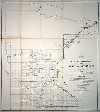
Sketch of the Public Surveys in the State of Minnesota
In stock
State of Minnesota. Surveys in southern half of state. Shows Indian Reserves on Mississippi, Pigeon and St. Louis Rivers. Numerous towns are shown, including Minneapolis and St. Paul, Mankato, Burlington, Otter Tail City and Fort Snelling. Shows national and state boundaries.
Size: 19.5 x 22 inches
Condition: Good, left margin originally trimmed close
Map Maker: General Land Office
Coloring: Black & White
Year: 1859
Condition: Good, left margin originally trimmed close
Map Maker: General Land Office
Coloring: Black & White
Year: 1859
In stock


