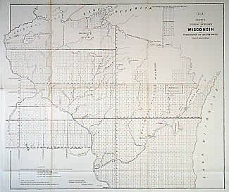
Sketch of the Public Surveys in Wisconsin and Territory of Minnesota
In stock
Wisconsin and Territory. of Minnesota. Surveys shown west of Mississippi in area previously labelled “Indian Country”. All but northern regions now surveyed east of Mississippi. St. Paul, Ft. Snelling, Prairie du Chien, and Dubuque are labelled. Also “Chipeway Land”, Menominee Cession of 1848, and Oneida, Menominee, and Stockbridge/Brothertown Reserves.
Size: 21 x 17.5 inches
Condition: Very Good, lower left margin originally trimmed close
Map Maker: General Land Office
Coloring: Black & White
Year: 1854
Condition: Very Good, lower left margin originally trimmed close
Map Maker: General Land Office
Coloring: Black & White
Year: 1854
In stock


