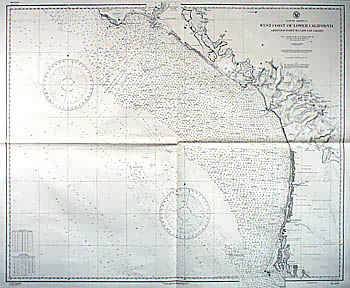
West Coast of Lower California
In stock
WWII Coastal Survey Map of Lower California.Chart #1493Originally published at Washington D.C. July 1896. Thismap is very detailed showing land masses, roads, towns,rivers, lakes, swamps, some topographic marks, towers,harbors, ledges, beaches, rocks, points, heads, shoals,fish trap areas, prohibited areas, coves, railroads,intracoastal waterways, and depth readings all along thecoast. This map would make a great gift if you live in thisarea or know someone who does.
Size: 39 x 33 inches
Condition: Excellent
Map Maker: U.S. Hydrographic Office
Coloring: Black & White
Year: 1896
Condition: Excellent
Map Maker: U.S. Hydrographic Office
Coloring: Black & White
Year: 1896
In stock


