Skip to content
FREE SHIPPING ON ORDERS OVER $85
Facebook
Instagram
Twitter
Contact Us
Newsletter
Checkout
49 Item(s)
-
$
5,176.50
Red Eyed Vireo
1 x
$
150.00
Counties of Northampton, Carbon, Monroe, and Lehigh (Pennsylvania)
1 x
$
55.00
A Time Table
1 x
$
90.00
Approximate Cotidal Lines of the Pacific Coast of the United States From Investigations in the Coast Survey
1 x
$
30.00
Commemorative Map of the Republic of Texas
4 x
$
50.00
The Worlds Statistics of Today (Geography, Population, Commerce, Religion)'
1 x
$
35.00
Omaha
1 x
$
40.00
Outline Plan of Monroe County, Mich.
1 x
$
75.00
Counties of Fayette, Effingham, Clay, and Marion, Illinois
1 x
$
75.00
County Map of the State of New Jersey
1 x
$
55.00
Sesquicentennial Map of Texas 1836-1986 (Texas Revolution 1835-1836)
6 x
$
125.00
Sesquicentennial Map of Texas 1836-1986 (Texas Revolution 1835-1836)
1 x
$
50.00
Mile High Lakes Quadrangle, Colorado
1 x
$
35.00
Counties of Allegheny, Washington, and Greene (Pennsylvania)
1 x
$
55.00
New Rail Road and County Map of Nebraska
1 x
$
150.00
Gulf of Venezuela, Peninsula de Guajira, Castilletes Anchorage and Approaches
1 x
$
65.00
North Coast of Columbia, Punta Baru to Punta Canoas
1 x
$
75.00
Counties of Platt, Champaign, and Vermillion, Illinois
1 x
$
75.00
Counties of Jefferson, Clarion, Indiana, and Armstrong (Pennsylvania)
1 x
$
55.00
Grand Canyon, 500 Piece Puzzle
1 x
$
24.00
Counties of Erie, Crawford & Venango (Pennsylvania)
1 x
$
50.00
Continental Divide Trail, 750 Piece Puzzle
1 x
$
25.50
Counties of Clearfield, Cambria and Blair (Pennsylvania)
1 x
$
55.00
Monaco - 1965
1 x
$
225.00
Boston & Maine Railroad and Connections
1 x
$
95.00
A QUALCUNO PIACE CALDO (SOME LIKE IT HOT)
1 x
$
95.00
Counties of Madison, Bond, and Clinton, Illinois
1 x
$
75.00
Plan of Boston, with Inset of Surrounding Areas
1 x
$
150.00
Purple Martin
1 x
$
250.00
U.S. Coast Survey Showing the Progress of the Survey from Cape Florida to Tortugas Islands
1 x
$
45.00
Louisiana Water Thrush
1 x
$
175.00
The Spoilers
1 x
$
100.00
Counties of Wayne and Pike (Pennsylvania)
1 x
$
55.00
Titanic
1 x
$
450.00
Selby's Fly Catcher
1 x
$
200.00
Pine Swamp Warbler
1 x
$
150.00
Alabama
1 x
$
35.00
Part of Custer and Logan Counties, Nebraska
1 x
$
75.00
Night Hawk
1 x
$
275.00
U.S. Geologic Survey 1946 Map of Lowell, Massachusetts
1 x
$
35.00
Eaton III
1 x
$
422.00
View Cart
Checkout
Search for:
Search for:
Home
Browse All
Christmas & Holiday Gift Ideas for Map & Print Lovers
Ancient Maps
Browse All
Ancient China
Ancient Egypt
Ancient Greece
Ancient India
Ancient Israel
Original, Antique Maps
Browse All
Browse by Location
City & County Maps
Framed Maps
Rare Maps
Military Maps
U.S. Coastal Survey Maps
General Land Office
Old Map Reproductions
Browse All
U.S. City Bird’s Eye Views
Manuscript Maps
War Maps
Old World Maps
Browse All
Original
Giclée Reproductions
Vintage Prints
Browse All
By Subject
Birds
Botanicals
Fish
More…
By Antique Print Makers
John James Audobon
Picturesque America
More…
Vintage Posters
Collecting Posters
Browse All
Original
Lithograph Reproductions
Giclée Reproductions
Replogle Globes
Browse All
Desk Models
Floor Models
Illuminated
4.7″
12″
16″
20
32
Books
Browse All
Books with Maps
Atlases
Reference Books
Historic Colorado Photos
Browse All
Boulder
Denver
Colorado Ski Towns
Colorado Art
Browse All
Kirsten Bingham
John Carlson
Steve Lowtwait
Penny Pearson
Puzzles
Vintage Maps
Old Map Reproductions
Vintage Prints
Custom Framing
Collector’s Guide
Time Charts of Historical Cartography
Antiquity 600 BC to 300 AD
Middle Ages 400 AD to 1400 AD
Renaissance 1470 AD to 1700 AD
History of Print Making
Wood Block
Line Engraving
Etching
Mezzotint Engraving
Stipple Engraving
Aquatint Engravings
Lithographs
Color Prints
General
What Is Meant By The Term “Antique Map”?
Condition of Antique Maps
Sizes of Antique Maps
Coloring of Antique Maps
Glossary of Terms
Factors Affecting the Value of Maps
What Should I Collect?
What Should I Pay?
The Care of Maps & Prints
How to Detect Reproductions?
About Us
Request Or Sell an Item
Request an Item
Sell an Item
Search for:
Reference Books
Default sorting
Sort by popularity
Sort by latest
Sort by price: low to high
Sort by price: high to low
Maps and Views of Washington DC
$
36.00
Add to cart
Details
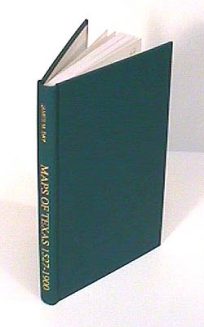
Maps of Texas, 1527-1900
$
45.00
Only 2 in stock. Order Now!
Add to cart
Details
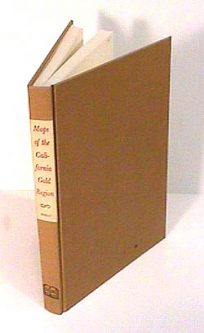
Maps of the California Gold Region
$
75.00
Add to cart
Details
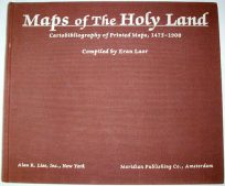
Maps of the Holy Land – Cartobibliography of Printed Maps, 1475-1900
$
900.00
Only 1 in Stock! Order Now!
Add to cart
Details
Maps Published by Congress 1817-1843
$
40.00
Only 2 in stock. Order Now!
Add to cart
Details
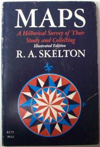
Maps: A Historical Survey of Their Study and Collecting
$
20.00
Only 1 in Stock! Order Now!
Add to cart
Details
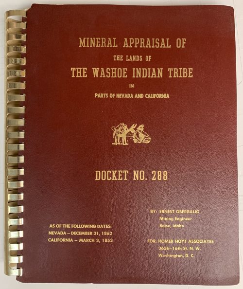
Mineral Appraisal of the Lands of the Washoe Indian Tribe in Parts of Nevada and California
$
30.00
Only 1 in Stock! Order Now!
Add to cart
Details
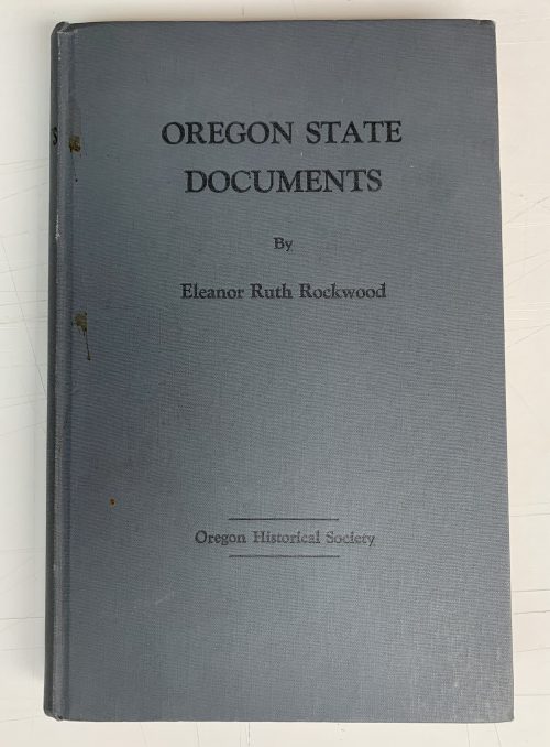
Oregon State Documents A Check List, 1843 to 1925
$
20.00
Only 1 in Stock! Order Now!
Add to cart
Details
Phillips’ Maps and Books>Atlases of WWI
$
25.00
Only 1 in Stock! Order Now!
Add to cart
Details
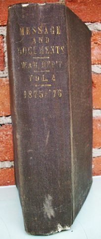
Report of the Secretary of War; Bring part of The Message and Documents Communicated to the Two Houses of Congress
$
95.00
Only 1 in Stock! Order Now!
Add to cart
Details
Rules and Regulations Mount Rainer National Park Washington
$
15.00
Only 1 in Stock! Order Now!
Add to cart
Details
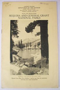
Rules and Regulations Sequoia and General Grant National Parks, Season from May 15-October 1
$
15.00
Only 1 in Stock! Order Now!
Add to cart
Details
Previous
1
2
3
4
Next
Page load link
Go to Top