Skip to content
FREE SHIPPING ON ORDERS OVER $100
Facebook
Instagram
Twitter
Contact Us
Checkout
9 Item(s)
-
$
2,135.00
Frenchmans Bay and Eastern Part of Mt. Desert Island, Maine
1 x
$
85.00
Solitary Flycatcher
1 x
$
125.00
Fulmar
1 x
$
150.00
General Chart of Alaska
1 x
$
75.00
Yellow Breasted Warbler
1 x
$
175.00
Larus Fuscus, Linn. (Lesser Black-Backed Gull)
1 x
$
500.00
Great Footed Hawk
1 x
$
375.00
Pine Swamp Warbler
1 x
$
150.00
Green Shank
1 x
$
500.00
View Cart
Checkout
Search for:
Search for:
Home
Browse All
Christmas & Holiday Gift Ideas for Map & Print Lovers
Ancient Maps
Browse All
Ancient China
Ancient Egypt
Ancient Greece
Ancient India
Ancient Israel
Original, Antique Maps
Browse All
Browse by Location
City & County Maps
Framed Maps
Rare Maps
Military Maps
U.S. Coastal Survey Maps
General Land Office
Old Map Reproductions
Browse All
U.S. City Bird’s Eye Views
Manuscript Maps
War Maps
Old World Maps
Browse All
Original
Giclée Reproductions
Vintage Prints
Browse All
By Subject
Birds
Botanicals
Fish
More…
By Antique Print Makers
John James Audobon
Picturesque America
More…
Vintage Posters
Collecting Posters
Browse All
Original
Lithograph Reproductions
Giclée Reproductions
Replogle Globes
Browse All
Desk Models
Floor Models
Illuminated
4.7″
12″
16″
20
32
Books
Browse All
Books with Maps
Atlases
Reference Books
Historic Colorado Photos
Browse All
Boulder
Denver
Colorado Ski Towns
Colorado Art
Browse All
Kirsten Bingham
John Carlson
Steve Lowtwait
Penny Pearson
Puzzles
Vintage Maps
Old Map Reproductions
Vintage Prints
Custom Framing
Collector’s Guide
Time Charts of Historical Cartography
Antiquity 600 BC to 300 AD
Middle Ages 400 AD to 1400 AD
Renaissance 1470 AD to 1700 AD
History of Print Making
Wood Block
Line Engraving
Etching
Mezzotint Engraving
Stipple Engraving
Aquatint Engravings
Lithographs
Color Prints
General
What Is Meant By The Term “Antique Map”?
Condition of Antique Maps
Sizes of Antique Maps
Coloring of Antique Maps
Glossary of Terms
Factors Affecting the Value of Maps
What Should I Collect?
What Should I Pay?
The Care of Maps & Prints
How to Detect Reproductions?
About Us
Request Or Sell an Item
Request an Item
Sell an Item
Search for:
Old Map Reproductions
Invalid Image Size
Default sorting
Sort by popularity
Sort by latest
Sort by price: low to high
Sort by price: high to low
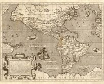
Old map of North America and Central America
$
30.00
Add to cart
Details
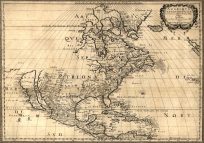
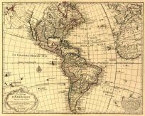
Old map of North America and Central America in 1650 by Nicolas Sanson
$
30.00
Add to cart
Details
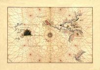
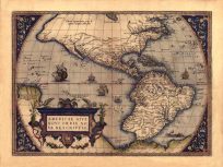
Old map of North America and South America
$
30.00
Add to cart
Details
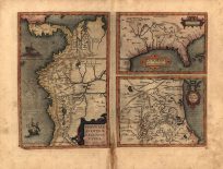
Old map of North America and South America
$
30.00
Add to cart
Details
Old map of North America and South America
$
30.00
Add to cart
Details
Old map of North America and South America
$
30.00
Add to cart
Details
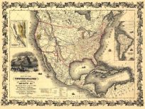
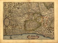
Old map of North America by Joseph Colton
$
30.00
Add to cart
Details
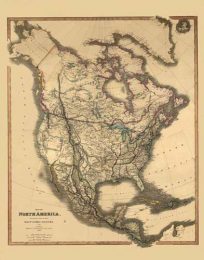
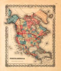
Old map of North America in 1849 by Joseph Colton
$
30.00
Add to cart
Details
Old map of North and South America
$
30.00
Add to cart
Details
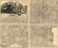
Old map of Northern Italy
$
30.00
Add to cart
Details
Old map of Northern Italy
$
30.00
Add to cart
Details
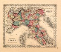
Old map of Piedmont, Italy
$
30.00
Add to cart
Details
Previous
1
…
170
171
172
…
207
Next
Page load link
Go to Top