 |
||
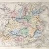
Map of China
Out of stock
This hand colored, steel engraved map is from Black’s General Atlas printed in 1844. Details on this beautiful map of China include the names of regions and important cities, illustrations of rivers, lakes and mountains. It contains a note listing the recently opened ports.Insets are included at a larger scale of Amoy, Hong-kong, Chusan, and Hainan.
Size: 15.5 x 11 inches
Condition: Excellent
Map Maker: Adam and Charles Black
Coloring: Hand Coloring
Year: 1844
Condition: Excellent
Map Maker: Adam and Charles Black
Coloring: Hand Coloring
Year: 1844
Out of stock