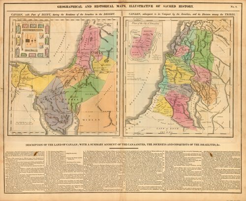
Geographical and Historical Maps, Illustrative of Sacred History
In stock
This beautiful map, illustrative of Sacred History, came from M. Lavoisnes Genealogical Historical Chronological and Geographical Atlas. The two maps show “Canaan, with Part of Egypt, during the Residence of the Israelites in the Desert” and “Canaan, subsequent to its Conquest by the Israelites, and its Division among the Tribes”. Below the maps contain important historical information. This map is accompanied by 3 pages of hand-colored historical tables.
Size: 20.5 x 16.5 inches
Condition: Very Good: some age toning
Map Maker: M. Lavoisne
Coloring: Original hand color
Year: 1820
Condition: Very Good: some age toning
Map Maker: M. Lavoisne
Coloring: Original hand color
Year: 1820
In stock


