 |
||
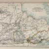
Canada (Central Provinces)
Out of stock
This beautiful map was made by Adam and Charles Black in 1889 for the library eddition of “The Scribner-Black Atlas of the World”. The central provinces of Canada are illustrated on this map. The names of regions and important cities, railroads, lakes and rivers are identified. These maps are in very good condition with only slight age toning and bright crisp color.
Size: 15.5 x 10.5 inches
Condition: Very Good - age toning
Map Maker: Adam & Charles Black
Coloring: Printed Color
Year: 1890
Condition: Very Good - age toning
Map Maker: Adam & Charles Black
Coloring: Printed Color
Year: 1890
Out of stock