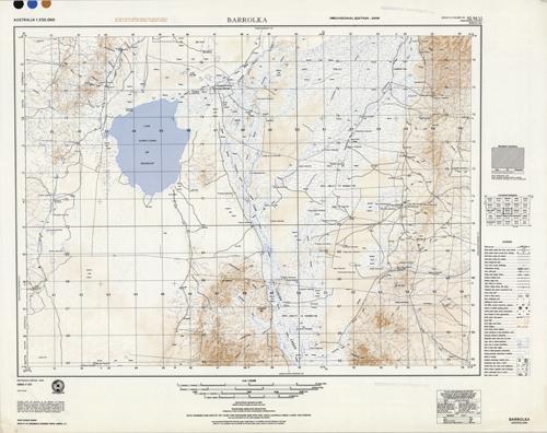
Barrolka, Canada
In stock
Prepared under the direction of the Minister for National Development, by the Division of National Mapping, this beautiful topographic map shows relief and contour features of a given area in Australia. In muted blues and browns, these maps give great detail and relief shading of the structure of the land. The features indicate built-up areas, roads, trails, railways, sand, cliffs, springs, marshes, rocks, reefs, and include some buildings, such as churches and schools. There are a couple faded stamps, “Automatic Distribution” in the margins.
Size: 24.5 x 18.5 inches
Condition: Very Good
Map Maker: Royal Australian Survey Corps
Coloring: Printed Color
Year: 1962
Condition: Very Good
Map Maker: Royal Australian Survey Corps
Coloring: Printed Color
Year: 1962
In stock


