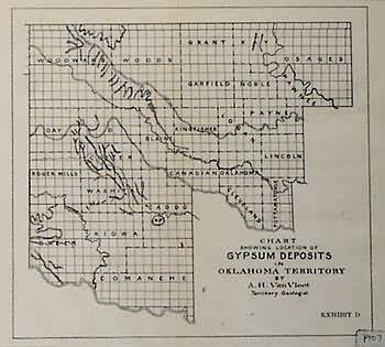
Chart Showing Location of Gypsum Deposits in Oklahoma Territory
Out of stock
This small map is a chart of Gypsum deposits in the Oklahoma Territory. It was made in 1903 for the U.S. Government by A.H. Van Vleet the territory geologist identified on the map. The map is black and white with identification of counties.
Size: 8.25 x 7.5 inches
Condition: Very Good-age toning
Map Maker: U.S. Government
Coloring: Black and White
Year: 1903
Condition: Very Good-age toning
Map Maker: U.S. Government
Coloring: Black and White
Year: 1903
Out of stock


