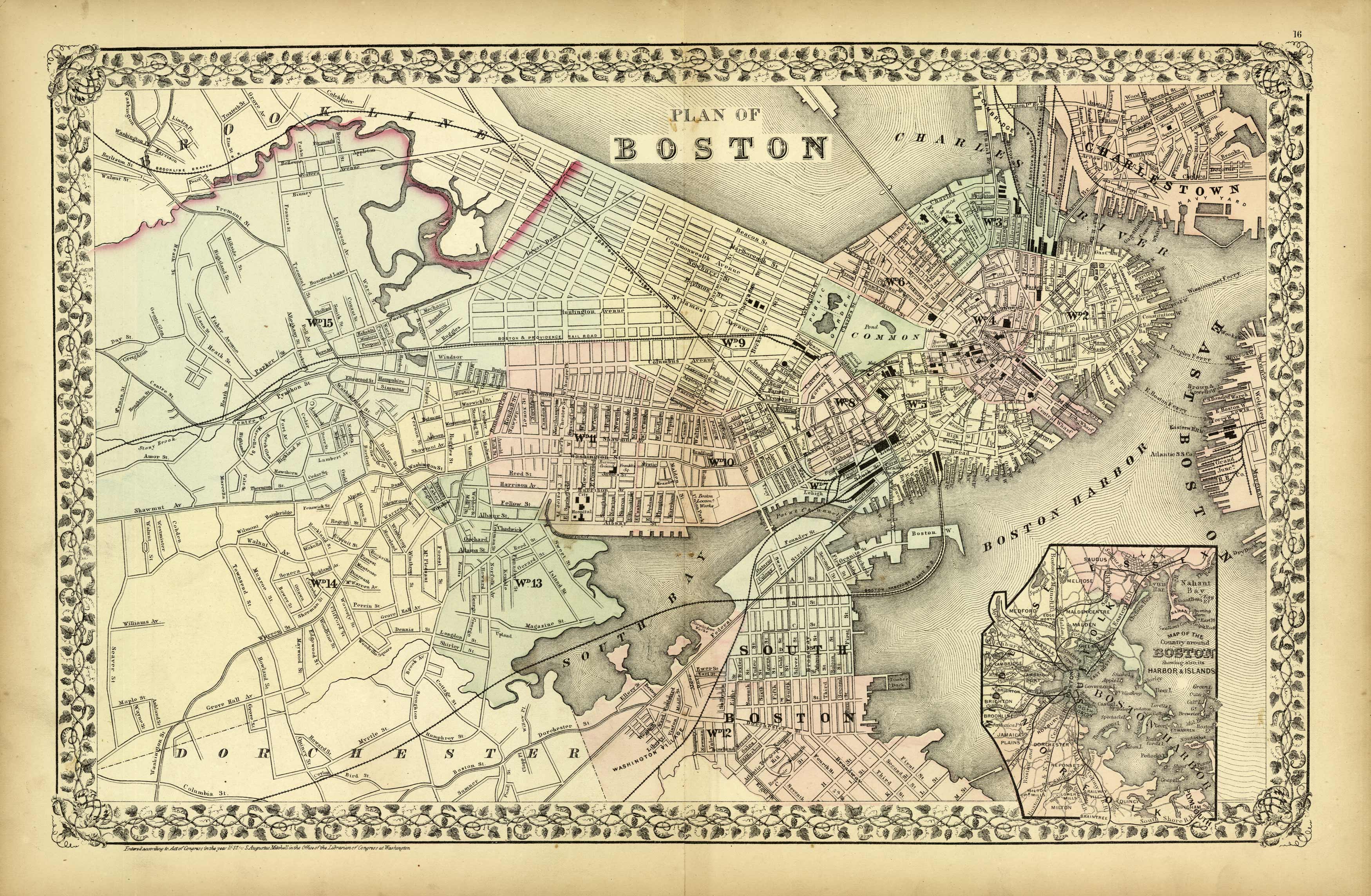
Plan of Boston
In stock
S. Augustus Mitchell Jr., made this hard to find map of Boston and the surrounding area in 1872. Surrounding the beautifully hand colored map is the characteristic traditional ivy style border. Details on the map included street names, parks, reservoirs, ferry lines, and identification of important landmarks. An inset map shows the country around Boston showing also its harbor and islands.
Size: 21 x 13 inches
Condition: Excellent
Map Maker: S. Augustus Mitchell
Coloring: Original Hand Coloring
Year: 1872
Condition: Excellent
Map Maker: S. Augustus Mitchell
Coloring: Original Hand Coloring
Year: 1872
In stock


