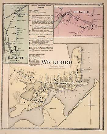
Maps of the towns of Wickford, Bellville, Wickford Station and LaFayette
Out of stock
This map is from the Atlas of the State of Rhode Island and Providence Plantations from Actual Surveys and Official Records compiled and published by D.G.Beers and Co. in 1870. The main map on this page is of Wickford, two insets show LaFayette and Wickford Station, and Bellville at a smaller scale. A list of Wickford Businesses is provided, including the names, service or product and general location of the business. Details include town names, street plans, lakes, rivers, parks, important buildings, the names and locations of major land owners and businesses, and railroads. This beautiful hand colored pastel map would make a great gift for a resident of the area interested in local history.
Size: 11.75 x 14.25 inches
Condition: Very Good, very light foxing
Map Maker: D.G. Beers
Coloring: Hand Color
Year: 1870
Condition: Very Good, very light foxing
Map Maker: D.G. Beers
Coloring: Hand Color
Year: 1870
Out of stock


