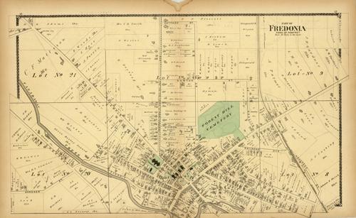
Town of Pomfret, part of Fredonia
In stock
This map is from the “Illustrated Historical Atlas of The County of Chautauqua, New York” published by F.W. Beers & Co. Residents of the town or county featured will value these maps of their home from a time long past. Fredonia from the town of Pomfret in Chautauqua County is shown here in pastels differentiating between districts. Detail of the area including land owners, rivers, rail lines, streets and major businesses are shown.
Size: 16 x 26.75 inches
Condition: Very Good, light age toning, small stain and tear in middle margin
Map Maker: F.W. BEERS
Coloring: Original Hand Color
Year: 1881
Condition: Very Good, light age toning, small stain and tear in middle margin
Map Maker: F.W. BEERS
Coloring: Original Hand Color
Year: 1881
In stock


