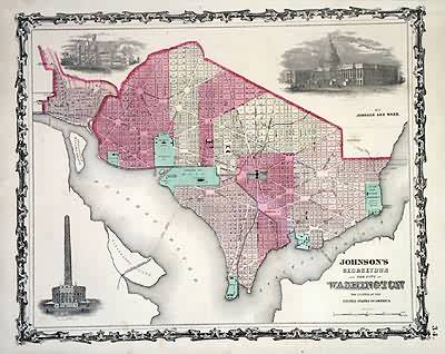
Johnsons Georgetown and the City of Washington, the Capital of the United States of America
In stock
This antique map came from Johnsons New Illustrated (Steel Plate) Family Atlas, published in 1863, by Johnson and Ward. These maps are some of the most colorful andaccurate maps produced in the 1860’s. Johnson maps are characterized by hand coloring in red and green and distinctive borders, including iron scrollwork and a Celticdesign. This beuatiful city map has depictions of Washington Monument, Smithsonian Institution and the Capitol.
Size: 15.5 x 12.5 inches
Condition: Very Good - light staining to margins, not affecting map
Map Maker: Johnson and Ward
Coloring: Original Hand Color
Year: 1863
Condition: Very Good - light staining to margins, not affecting map
Map Maker: Johnson and Ward
Coloring: Original Hand Color
Year: 1863
In stock


