 |
||
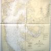
Maryland- Chesapeak Bay, Cove Point to Sandy Point
Out of stock
This coastal survey was made in Washington D.C. on February 2, 1945 by the U.S.Coast and Geodetic Survey department. Chesapeak Bay in Maryland, Cove Point to Sandy Point, is illustrated on this map. Details include the names of creeks and rivers, depth readings, bridges, important buildings along the coast,railroads, cable areas, and the names of some cities. Most recent corrections, buoys, beacons, and lights are hand stamped on the map Notes on the map read: Caution Improved Channels- The side limits of the improvement are shown by broken lines. The controlling depth through the channel, on the date given, is placed in or alongside the channel, or in a seperate note, but no depth greater than the project depth is given. Because of possible shoaling, particularly at the edges, it must not be inferred that the depth stated exsisted throughout the entire width of the improvement on the date of the examination unless so stated, or that it has not since decreased in places across the entire width.
Condition: Excellent
Map Maker: U.S. Coast and Geodetic Survey
Coloring: Machine Color
Year: 1945
Out of stock