 |
||
Maryland-Virginia, Potomac River- Chesapeake Bay to Piney Point
Out of stock
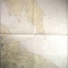
This coastal survey was printed in Washington D.C. in 1945 by the U.S. Coast and Geodetic Survey. The Potomac River between Chesapeake Bay and Piney Point is illustrated on this map. Details include important cities, monuments, buildings,railroads,and parks along the coast, depth readings, and bridges. This map would make a great gift for a resident of the area. Note on Map: “Warning: Aids to Navigation may be altered, interrupted or removed without notice. In general, temporary changes due to war conditions are not incorporated on the chart. “Restricted Area-Chesapeak Bay- Only through navigation of comercial vessels, proceeding on established steamer lanes, will be permitted.”
Size: 35 x 39.5 inches
Condition: Excellent
Map Maker: U.S. Geodetic Survey
Coloring: Machine Color
Year: 1945
Condition: Excellent
Map Maker: U.S. Geodetic Survey
Coloring: Machine Color
Year: 1945
Out of stock