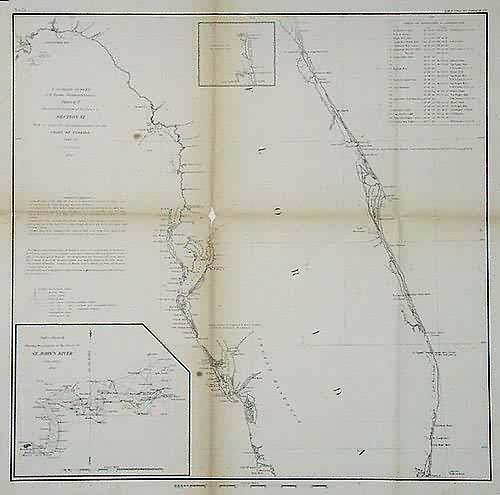
U.S. Coast Survey Showing the Progress of the Survey in Section VI — The Coast of Florida
In stock
This black and white, antique coastal survey was made for the United States Coast Survey. The surveys provide depth readings and notes on important coastal characteristics of the area mapped. The names of harbors, rivers, islands, light houses, channels, shoals, capes, inlets, and coastal towns are identified on the map. These charts show areas that have likely undergone significant changes due to modifications and recessions of coastal lands, making them fascinating to anyone interested in local geography and history. This map of Florida also has inset maps of St. John’s River and the Easterr Coast. Note: Age toning around the folds in these maps is quite common. Map is sold folded as issued.
Size: 16.5 x 16 inches
Condition: Very Good
Map Maker: US Coast Survey Office (US Government)
Coloring: Black and White
Year: 1856
Condition: Very Good
Map Maker: US Coast Survey Office (US Government)
Coloring: Black and White
Year: 1856
In stock


