 |
||
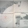
Virginia- Hampton Roads, Rangefinder and Compass Testing Chart
Out of stock
This coastal survey map was made in Washington D.C. by the U.S. Hydrographic Office in 1941. A rangefinder and compass testing chart of Hampton Roads, Virginia is illustrated on this map. Most recent corrections are stamped on the map.
Size: 41.5 x 29 inches
Condition: Excellent
Map Maker: U.S. Coast and Geodetic Survey
Coloring: Machine Color
Year: 1941
Condition: Excellent
Map Maker: U.S. Coast and Geodetic Survey
Coloring: Machine Color
Year: 1941
Out of stock